Beautiful Anthony’s Nose Hike: All You Need to Know
Anthony’s Nose hike is one of the most well-known hikes in the Hudson Valley and a very popular day trip from New York City. It is part of the Hudson Highlands State Park, one of the many beautiful New York State Parks scattered throughout New York.
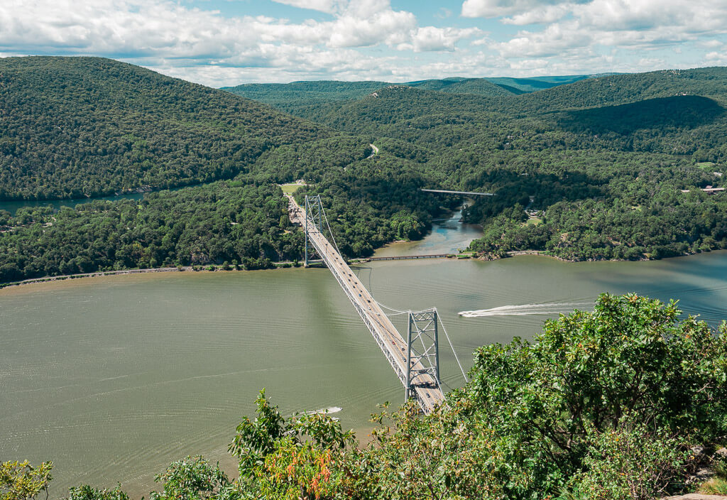
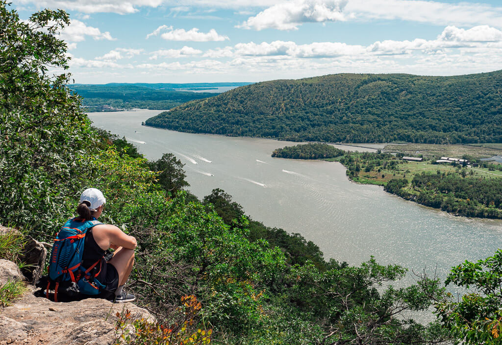
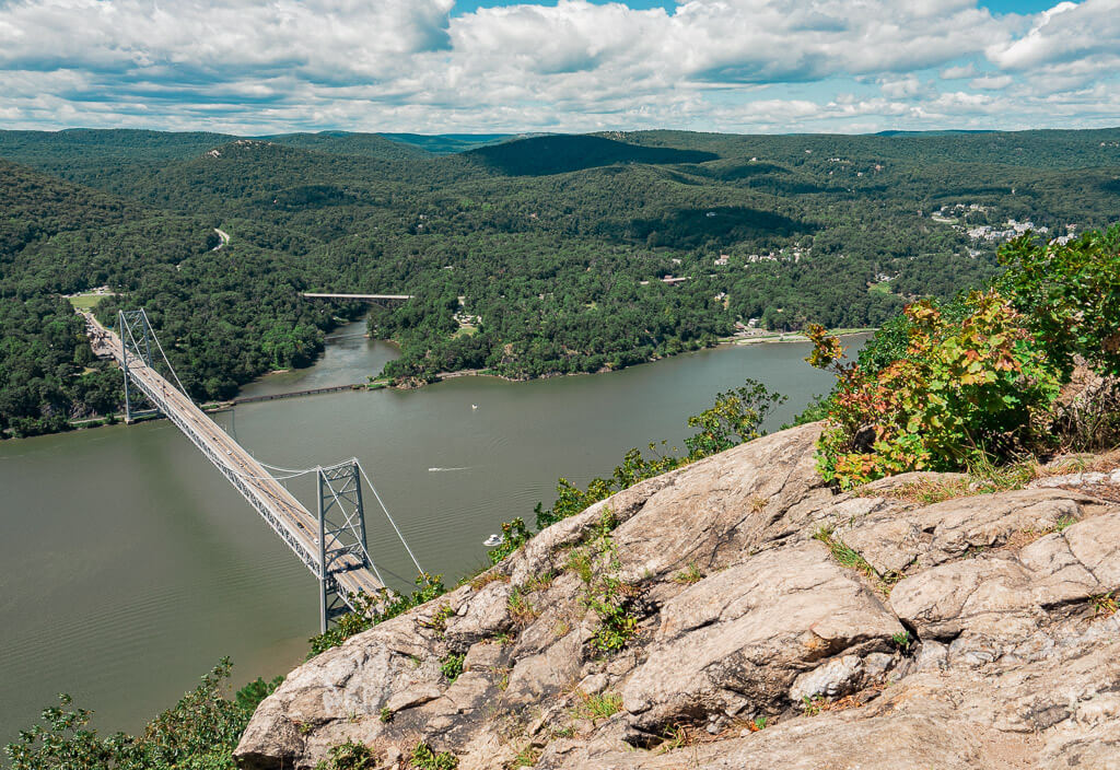
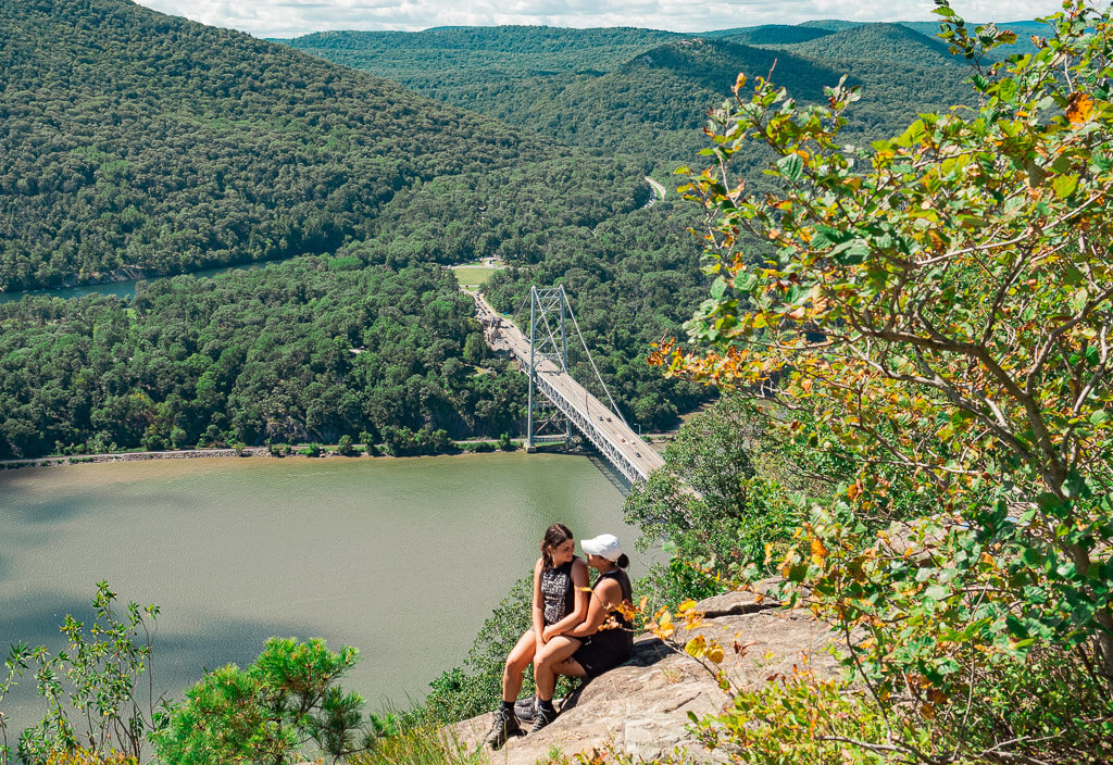
On this short hike, you will make your way up to the famous rock formation where the trail got named after. Anthony’s Nose peak is almost directly above the east end of the Bear Mountain Bridge, so expect beautiful views of the Hudson River, spectacular waves of mountain ranges, and the iconic Bear Mountain Bridge.
Make sure to read this post to get all the essential information about Anthony’s Nose parking, how to hike the Anthony Nose trail, recommendations for more fun activities, and unforgettable hikes in the Hudson Valley.
This post may contain affiliate links. If you make a purchase through them, we get a small commission at no extra cost to you. It helps us create free content for you to enjoy. Learn more about our disclaimer here. Thanks for your support!
How Do I Get to Anthony’s Nose Trailhead?
Anthony’s Nose is located on the northern end of Westchester County along the east side of the Hudson River in the town of Cortlandt, New York. From New York City it is easy to reach with public transportation or a personal vehicle.
How Do You Get to Anthony’s Nose by Train?
Take the Metro-North train from Grand Central to Cortlandt via the Hudson Line. From there, it is about a 10-minute ride to the trailhead. You can easily book an Uber or Lyft for the last stretch.
How Do You Get to Anthony’s Nose by Car?
It is about a 60 to 90-minute drive, depending on where you are coming from in New York City. The shortest way is from the middle of Manhattan. Plan on driving for an hour or so depending on traffic at the time you are going. You will want to take the Palisades Interstate Parkway North to the Anthony’s Nose trailhead.
Want to enjoy more of the Hudson Valley area? Rent a car for your trip to the Anthony Nose trail.
Different Trail Options
Before heading out to hike the Anthony Nose trail, be aware that there are 3 different trailhead options to choose from. In this post, we concentrate on the route from the trailhead off of Route 9D following the Appalachian Trail to Camp Smith Trail. Here is an overview of the various routes you can take:
1. Trailhead off of Route 9D
The Anthony’s Nose trailhead is located on the east side of the Bear Mountain Bridge off of 9D. You will find the start of the trail on the right-hand side of the road if you are traveling from south to north. You should have no problem spotting the trailhead as you get closer.
There is only roadside parking available at this trailhead. Fellow hikers will park their cars along both sides of the road and will try their best to squeeze into any available opening along the way. Space is very limited and goes very quickly. You will want to arrive early for this hike to avoid missing out on a spot. Also, make sure to park in a designated parking area, so you don’t risk getting an expensive ticket.
2. Trailhead II
You can also start from Anthony’s Nose Trailhead II which will add about 0.3 of a mile to your hike. Simply put Anthony’s Nose Trailhead II into Apple Maps to find the directions to the trailhead. In case you are not using Apple Maps, here is the address of the trailhead:
5 Bear Mountain Bridge Rd
Cortlandt Manor, NY 10567
3. Bear Mountain Toll House
Your last option is to hike to Anthony’s Nose from the Bear Mountain Toll House along the Camp Smith Trail. This is the longest and most strenuous way to reach Anthony’s Nose. The hike will be about 7.5 miles in length.
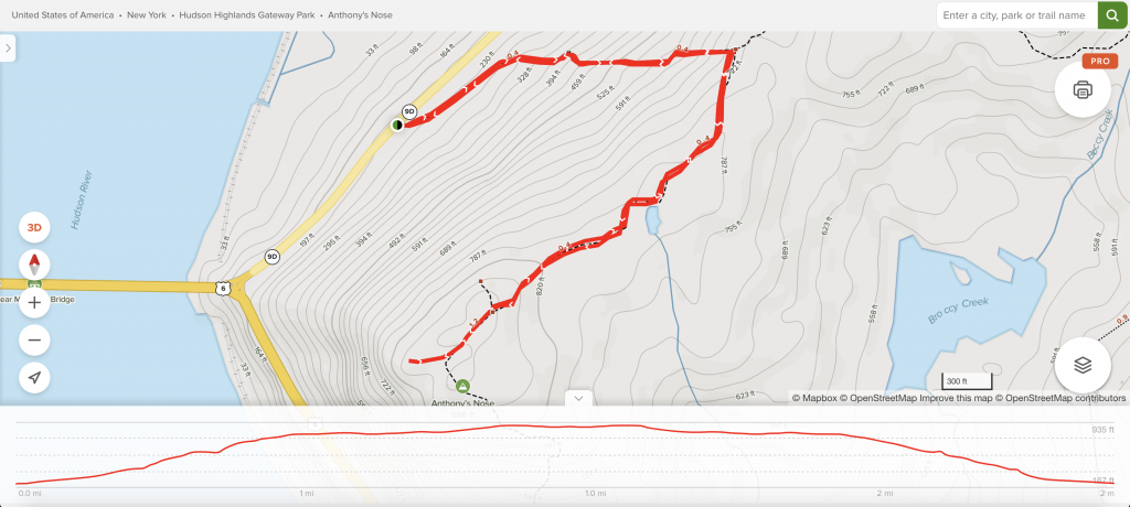
Refer to Anthony’s Nose Trail Map to see where the different trailheads for the hike are located.
What to Expect On Anthony’s Nose Hike
Anthony’s Nose Trail Map – Below is a Google Map locating the 3 different trailhead options to Anthony’s Nose Hike. Be sure to save this Google Map for your trip to the Anthony Nose Trail.
General Information about the Anthony’s Nose Hike
Difficulty: Moderate
Length: 1.9 miles
Type of Hike: Out and Back
Elevation Gain: 675 ft
Location / Parking: Off of Route 9D in Cortlandt near the Bear Mountain Bridge
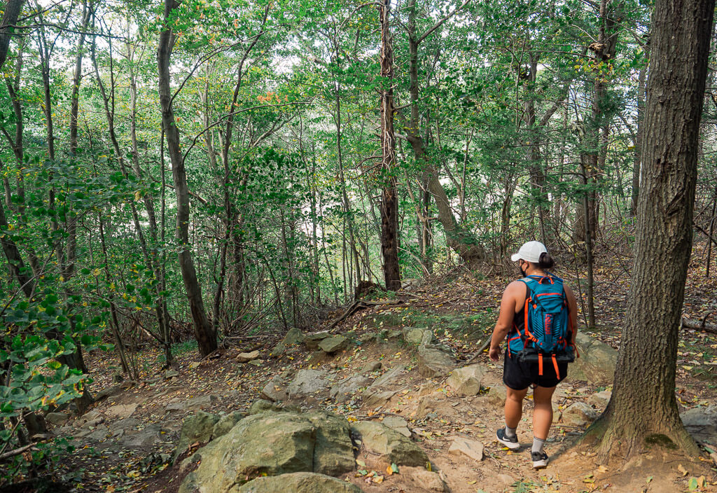
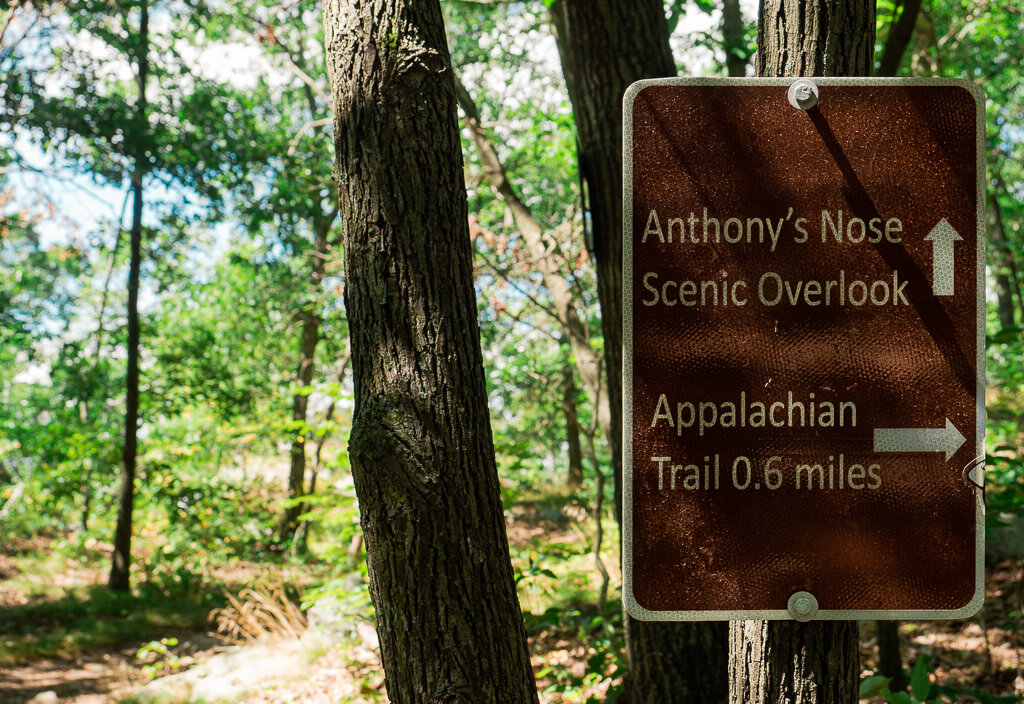
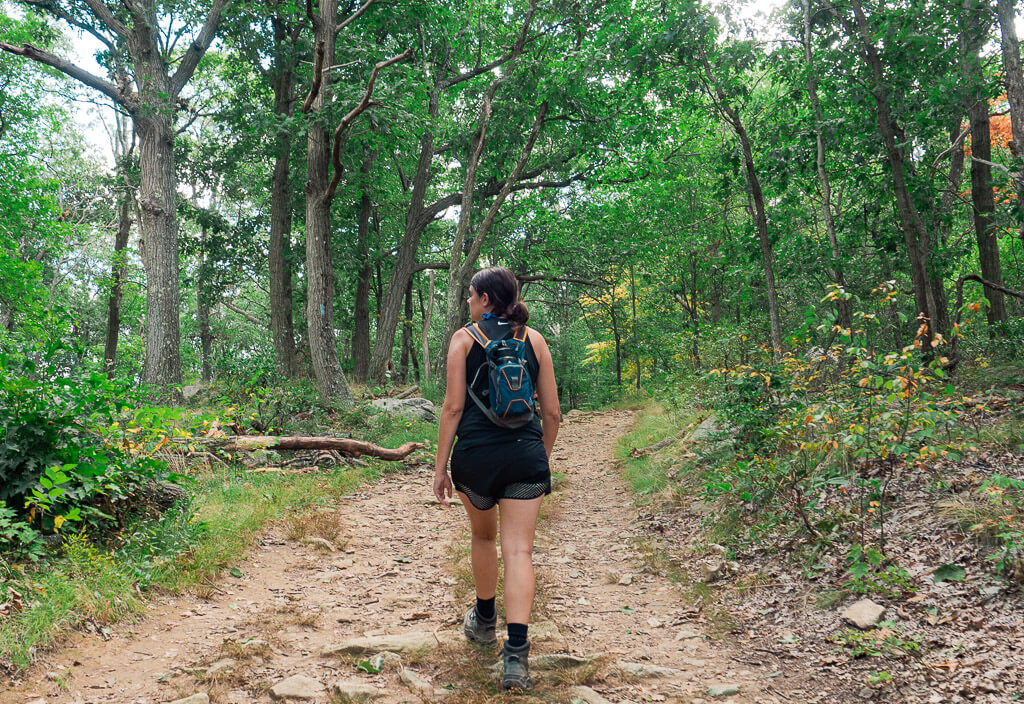
By the time you get to the trailhead, which is easily spotted by a sign with some information, we are sure you are eager to start your climb up to Anthony’s Nose to take in the view everyone is talking about.
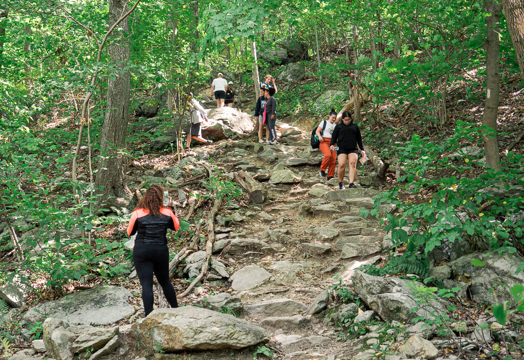
The trail is an immediate steady uphill climb for just over 0.5 of a mile. Follow the white blaze trail markers which are specifically designated for the Appalachian Trail. After your legs get a nice quick burning sensation, you will come to an intersection. Here, make a left to now follow the blue blaze trail markers for the Camp Smith Trail. The blue markers will lead you to Anthony’s Nose.
The rock formation Anthony’s Nose got the name from the prior owner Pierre Van Cortlandt in 1697. It is said that he named the peak after the pre-revolutionary war sea captain Anthony Hogan. The Captain was well known for the structure of his nose which to Van Cortlandt resembled the cliff now known as Anthony’s Nose.
The Camp Smith Trail (blue) widens and opens up quickly. After about 10 minutes, you will see a sign for the viewpoint. Just off to the right of this sign, there is the legendary Anthony’s Nose peak at 899’ feet.
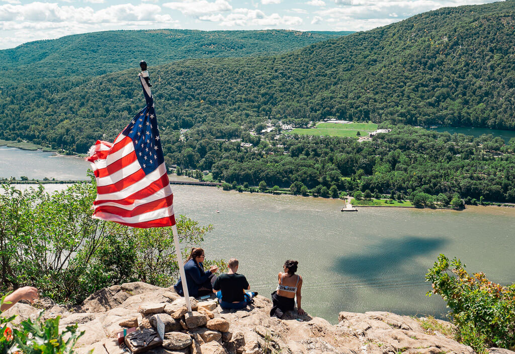
You will know you have made it to the right spot since you will be greeted with tons of fellow hikers and an American Flag waving in the wind. Check out that view overlooking the Hudson River, and the Hudson Valley Region as a whole. You made it! Can you spot the Bear Mountain Bridge and the Bear Mountain State Park across the way?
Top Tip: Be Prepared for the Wind → Since you are hiking to the top of a mountain, you can expect it to be a tad windy up there. Depending on the time of year you are hiking, you may want to carry a light or midweight jacket to protect yourself at the top.
If you are looking for a more quiet and less crowded place to enjoy a little picnic on top of the mountain, you can relax on the adjacent peak which you can access from just left of the sign which led you to Anthony’s Nose. But do keep in mind that the views are not as spectacular as Anthony’s Nose peak.
Top 5 Hiking Essentials for Every Hike
Day Hiking Packs
Deuter is one of the top brands for hiking packs and just happens to be our favorite. We currently use the Deuter Speed Lite 22 SL which has a more slimming design to fit a women’s back perfectly.
Insulated Water Bottle or Hydration Pack
We found out very quickly that having a good insulated water bottle makes a world of difference on our hiking trips. Personally, we love the Hydroflask 32 oz. Wide Mouth insulated water bottle which comes in many different designs. Additional accessories we like for our Hydroflask are the 32 oz Straw Lid, packable bottle sling, and Flex Boot. Other top brands we would recommend are Camelback and Yeti.
Durable Hiking Footwear
Hiking up the mountains in the Hudson Valley area requires sturdy hiking boots you can trust. We currently (mostly) use the Columbia Newton Ridge Plus Waterproof Hiking Boot and are totally satisfied with them, especially because they are lighter than many other boots.
Comfortable Hiking Socks
Trust us, a quality hiking sock with a good cushion can make a huge difference in how your feet will feel after any hike. Our absolute favorite hiking sock brand is Darn Tough.
Photography Gear
There is never a hike we go on without having our photography gear with us. Peak Design with its many smart photography accessories makes capturing our adventurous hiking moments so much easier. Our ultimate favorite is their capture clip which simply attaches your camera to your backpack for quick accessibility.
FAQs for Anthony’s Nose Hike
1. Is Anthony’s Nose a Hard Hike?
Anthony’s Nose hike difficulty is considered to be moderate. If we had to rate this hike on a scale of 1-10 with 10 being the most difficult and 1 being the easiest, Anthony’s Nose hike difficulty would land around a 6. What makes the Anthony’s Nose hike difficulty a 6, is the section of a steep incline that requires a little bit of endurance. Once you reach the top of this steep section, you will still have a small incline but it is much more gradual.
2. How Long Does it Take to Hike Anthony’s Nose?
Plan around 2 hours for the complete out and back hike. You can most likely reach Anthony’s Nose peak in under an hour depending on your shape and how fast you like to hike. Take into consideration that a portion of the trail is a steep uphill climb. If you are the type of person to enjoy a break frequently to take a breath or snap a bunch of photos, you may need some extra time. The way down is usually a little shorter.
Don’t forget that the highlight of the trail is waiting for you at the top. Plan enough time to take in the views, you truly deserve it after that climb.
3. What is the Best Season for Anthony’s Nose Hike?
One of our favorite times of the year to hike the Hudson Valley is during the Fall season to enjoy the unique New York fall foliage. Being high above the Hudson River, the climb up to Anthony’s Nose provides perfect unobstructed views of the area’s bright fall colors.
Nearby Attractions in the Hudson Valley
The following attractions are listed based on the distance they are away from the Anthony’s Nose hike, beginning with the shortest. All attractions are within a 30 minutes drive from the trailhead.
Bear Mountain State Park – Bear Mountain State Park offers various recreational activities from hiking, biking, picnicking, swimming, paddling, and more. The Perkins Memorial Tower is a popular park attraction. The state park is located on the opposite side of the Bear Mountain Bridge.
Cold Spring, NY – Cold Spring, rated as one of the most picturesque towns in the Hudson Valley, is located approximately 8 miles north of Anthony’s Nose Hike. Wander along visiting the historic landmarks and dine in one of the charming restaurants after an exciting day of hiking.
West Point Foundry Preserve – Just on the other side of Anthony Nose trail is the West Point Foundry Preserve. Here, you can walk on various hiking trails to learn more about the old grounds of the area’s most important industrial site.
Harriman State Park – One of the biggest New York State Parks attracts visitors with numerous lakes, hiking trails, beaches, and camping areas to enjoy. The best thing is it is just about 13 minutes southwest of Anthony’s Nose.
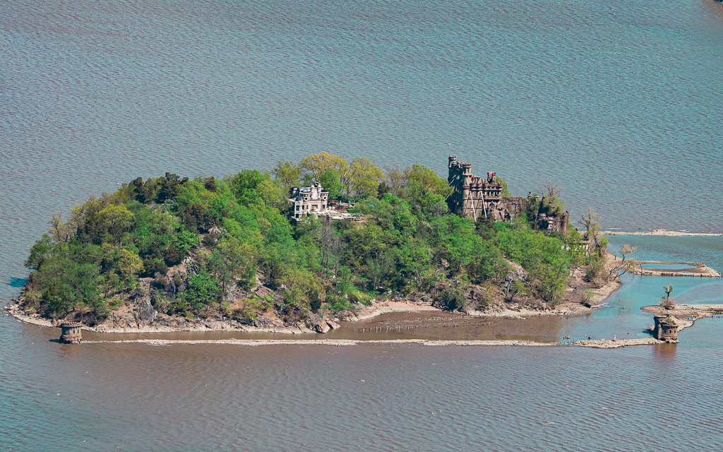
Bannerman Castle – There are several options to take a tour of Bannerman Castle on Pollepel Island. No matter if you book a boat tour, or take an adventurous kayaking trip to the island, you will be fascinated by the gorgeous scenery and rich history of the grounds.
West Point (United States Military Academy) – Visit the respected West Point (Military Academy) located just 20 minutes from the Anthony Nose trail. Check out all the West Point Tours offered to find the best one for you to dive deeper into the military role of this interesting area.
Beacon, NY – 15 miles north of Anthony Nose trail you will find the trendy town of Beacon. Take a walk down Main Street for lively restaurants, bars, and unique shops. You can’t miss Beacon Falls, the town’s beautiful waterfall.
Newburgh, NY – Take the drive across the river to Newburgh and enjoy a special dinner on the waterfront. There is a variety of restaurants with different price ranges you can choose from that sit along the Hudson River.
More New York Hiking Trails
Breakneck Ridge Trail – This trail is one of the most popular Hudson Valley hiking destinations. The roughly 3.2-mile loop uphill with tough steep inclines is a challenge, but you get rewarded with outstanding views of the Hudson Valley when you arrive at the top.
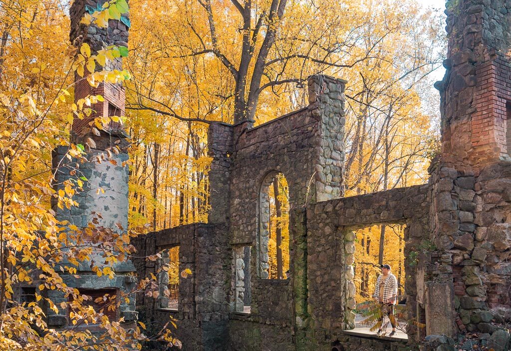
Cornish Estate Trail – This easy 1.8-mile scenic hike through the woods leads you to the historic ruins of the Cornish Estate. See how nature has taken back the area of a once-living and thriving homestead. It is a real paradise for lovers of spooky places or history geeks who love to admire old structures.
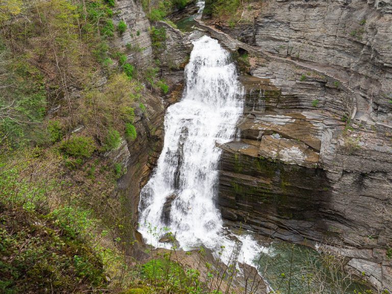
Indian Brook Falls Trail – Take a walk on this very short ungroomed hiking trail leading to a charming Hudson Valley waterfall. This trail can sometimes be overlooked by the more popular Constitution Marsh area down the road.
Minnewaska State Park Trails – Enjoy more of New York’s outstanding hiking trails in Minnewaska State Park. Each trail offers a different feature from plunging waterfalls, dramatic cliffs, lakes, and more. This is one of our absolute favorite places to hike in the area.
Mount Beacon – If you are in for a long steep climb, give the Mount Beacon trail a try. Most hikers will call it quits when they make it to the overlook of the Hudson River, but you can also keep pushing to climb up Mount Beacon Fire Tower to get a 360-degree view.
Storm King Mountain – A moderate 2.4 miles climb with tons of scenic vistas will bring you up to the top of Storm King Mountain. The trail is a perfect combination of climbing and hiking for all types of hikers to enjoy.
Hudson Valley Accommodations
New York’s Hudson Valley is filled with beautiful accommodations throughout the region. But searching for hotels just located in the Hudson Valley may be overwhelming and won’t point you in the right direction.
If you are looking for an accommodation close to the Anthony Nose trail, we would suggest looking for hotels in nearby cute Hudson Valley towns, like Cold Spring, Cortlandt Manor, and Beacon.
What was Your Favorite Experience on the Anthony’s Nose Hike?
Let us know in the comments below!
Our Other Resources for Hudson Highlands State Park
- How to Hike the Mysterious Cornish Estate Trail
- How to See the Picturesque Indian Brooks Falls
- Hiking Breakneck Ridge: How Tough Actually is this Hike
- The Ultimate Guide to 11 Best Cold Spring Hiking Trails
You May Also Like
- Hudson Valley: 33 Most Beautiful Trails for Hiking in Hudson Valley
- Minnewaska State Park: 13 Most Scenic Minnewaska State Park Trails
- Upstate New York: 34 Top Rated Best Hikes Upstate New York
- New York City: 59 Best Places in Manhattan to Visit for All Visitors
- New York City: 29 Best Views of NYC: Manhattan Skyline and More
- Quotes: 101+ Best Hiking Quotes to Inspire Your Future Adventures
- Quotes: 80+ Best Mountain Quotes to Inspire Your Adventures
- Hiking: 15 Most Helpful Hiking Apps to Download
- Hiking: What You Should be Packing for a Hike: The Essentials + Extras
- Hiking: 100+ Best Gifts for Hikers to Buy
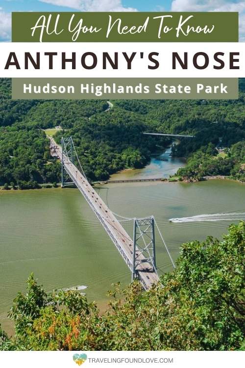
Save this Post for later on Pinterest!
Did you like this post? Subscribe to our newsletter and we’ll send you more unique travel tips, updates, and even FREE content!