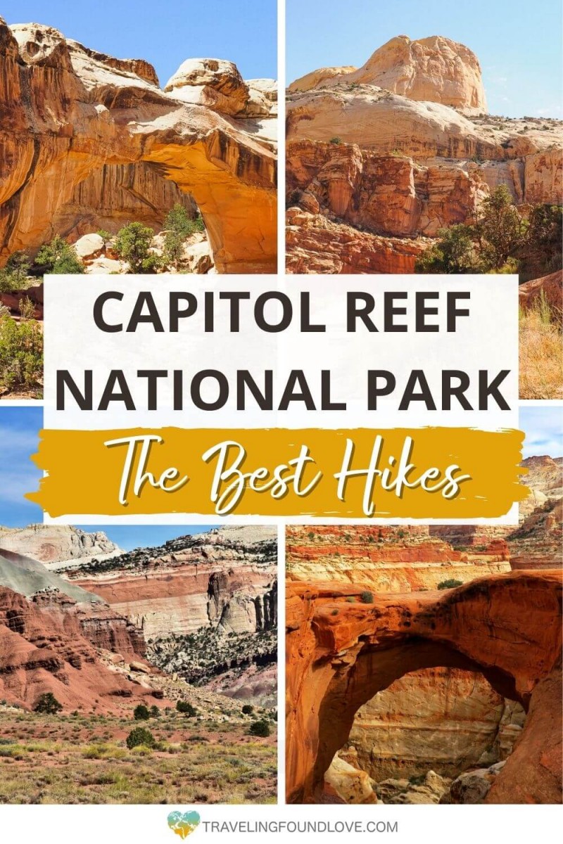
Explore 10 Striking Capitol Reef Hikes in the Fruita District
Capitol Reef is one of Utah’s Mighty 5 National Parks. Although overseen by many, this National Park is a hidden gem in the heart of red rock country, located in south-central Utah. The best way to explore the beauty of this underrated national park is on the striking Capitol Reef hikes.
Before visiting Capitol Reef Utah, we were not really sure what to expect, but this park blew us away with its unique landscape from the impressive narrow canyon, to gorgeous rock formations, and majestic juniper trees.
A little curious? Then see our list of the most stunning Capitol Reef National Park hiking trails, other unique activities you cannot miss (including delicious foods), the best tips for visiting the park, and more.
Now, it is time to find out more about the best hikes in Capitol Reef Utah.
Our Other Resources for Utah’s National Park
- Best Hikes in Zion National Park
- Best Bryce Canyon Hikes for Your Bucket List
- Trails to Hike Arches National Park
- The Best of Island in the Sky Canyonlands National Park
- Plan a Trip from Zion to Bryce Canyon: 2 Utah National Parks
- Explore Utahs National Parks in One Unforgettable Road Trip
This post may contain affiliate links. If you make a purchase through them, we get a small commission at no extra cost to you. It helps us create free content for you to enjoy. Learn more about our disclaimer here. Thanks for your support!
- Entrance fee: Vehicle: $20, Per Person (without a vehicle): $10, Motorcycle: $15. Your entry ticket is valid for 7 consecutive days, including the date you purchased it.
- Best time to visit: Spring and Fall (April to June and September to October).
- Where to stay: If you are looking to stay within the park’s boundaries, Fruita Campground (NPS) is your option. If you are looking to stay outside the park, you will find good accommodations in Torrey.
- How to get there: The closest airport to Capitol Reef National Park hikes is Salt Lake City International Airport (SLC).
- How to get around: The best way to get around in the park is by driving your own vehicle along the Capitol Reef Scenic Drive and Highway 24.
- Permits: None
Getting to Capitol Reef National Park
To visit Capitol Reef National Park, it is best to start in Salt Lake City, Utah. The park is about 3.5 hours from Salt Lake City.
You will need to rent a car at the airport to make the journey to Capitol Reef National Park.
Purchase the America The Beautiful Pass
Plan on visiting a lot of National Parks when you are in Utah? Then, America the Beautiful pass can help you save a lot of money!
How to Get Around in Capitol Reef
Getting around Capitol Reef National Park will require the use of a vehicle. There is NO shuttle service within the park.
But don’t worry. Navigating yourself through the park is extremely easy. Everything in the park can be accessed from either Highway 24 or Capitol Reef Scenic Drive.
Highway 24 splits the park in two. It enters the park from Torrey, Utah, the West, and leaves the park to the East towards Hanksville, Utah.
The only place to turn off Highway 24 is at the Visitor Center in the Fruita District. Here you can reach the campground, Gifford House, and the Capitol Reef Scenic Drive. However, remember that this is not a loop. To return back to Highway 24, you will have to turn around at the end of the scenic drive.
What is Capitol Reef Known For?
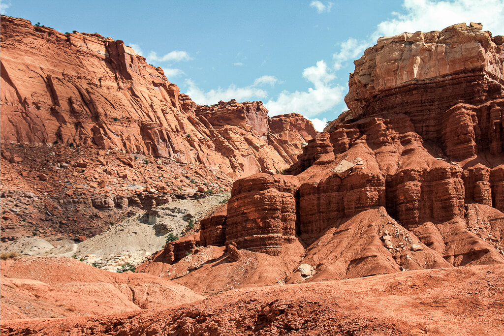
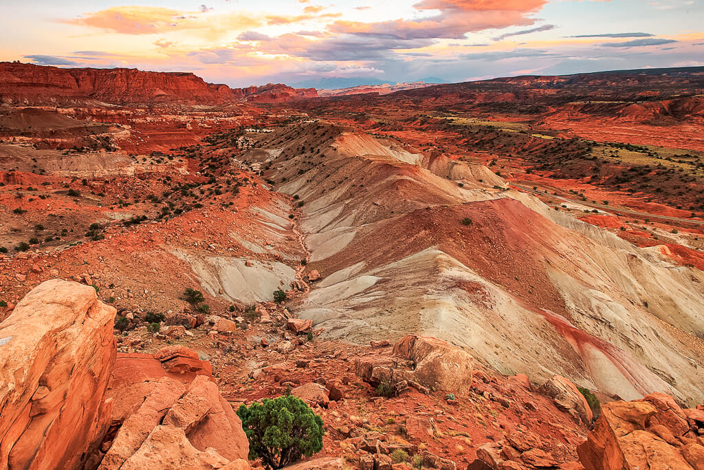
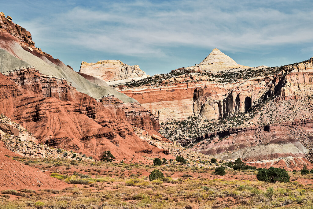
Capitol Reef Utah is filled with amazing hidden gems but most importantly it is known for the Waterpocket Fold. The Waterpocket Fold is a geologic monocline, which is a wrinkle in the earth. It extends for approximately 100 miles, running from Thousand Lake Mountain to Lake Powell.
Along the entire length of the fold, rocks have pushed up for millions of years, while erosion has cut through and carved out layers, resulting in narrow canyons and other interesting rock formations.
List of the Best Capitol Reef Hikes in the Fruita District
1. Sunset Point
Difficulty: Easy
Length: 0.8 miles
Type of Hike: Out and back
Elevation Change: less than 50 ft
Trailhead: Goosenecks Parking Area
Entrance Fee: No
Time: 20 – 30 minutes
A great short family-friendly hike just a few miles away from the visitor center on Highway 24. The sunset trail is relatively flat, following the canyon rim of the Sulphur Creek. Wondering how this trail got its name? It is a perfect place to watch a sunset, due to its higher elevation and east-facing positioning.
Sunset Point is the shortest of the Capitol Reef hikes. From the parking lot, you can also take the quick trail to Gooseneck Overlook for an added bonus.
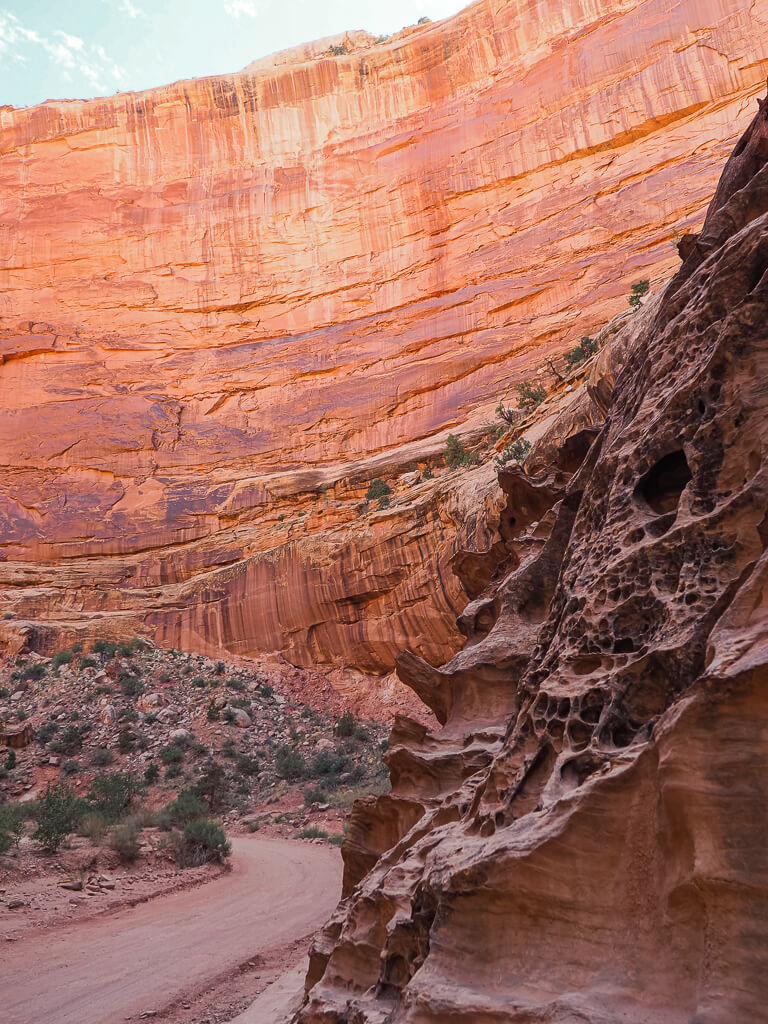
2. Capitol Gorge
Difficulty: Easy
Length: 2.0 miles
Type of Hike: Out and back
Elevation Change: 80 ft
Trailhead: End of unpaved section of the Capitol Reef Scenic Drive
Entrance Fee: Yes
Time: 1 hour
Walk back in time on this historic pioneer road trail through Capitol Gorge. The trail follows the dry stream bed in the narrow canyon, which is surrounded by high canyon walls. Along the trail, you will find remains of prehistoric (petroglyphs) and historic remains (the Pioneer Register), a natural arch, and several water-filled potholes (the Tanks).
This is one of the Capitol Reef hikes that really captivates the essence of Capitol Reef’s history.
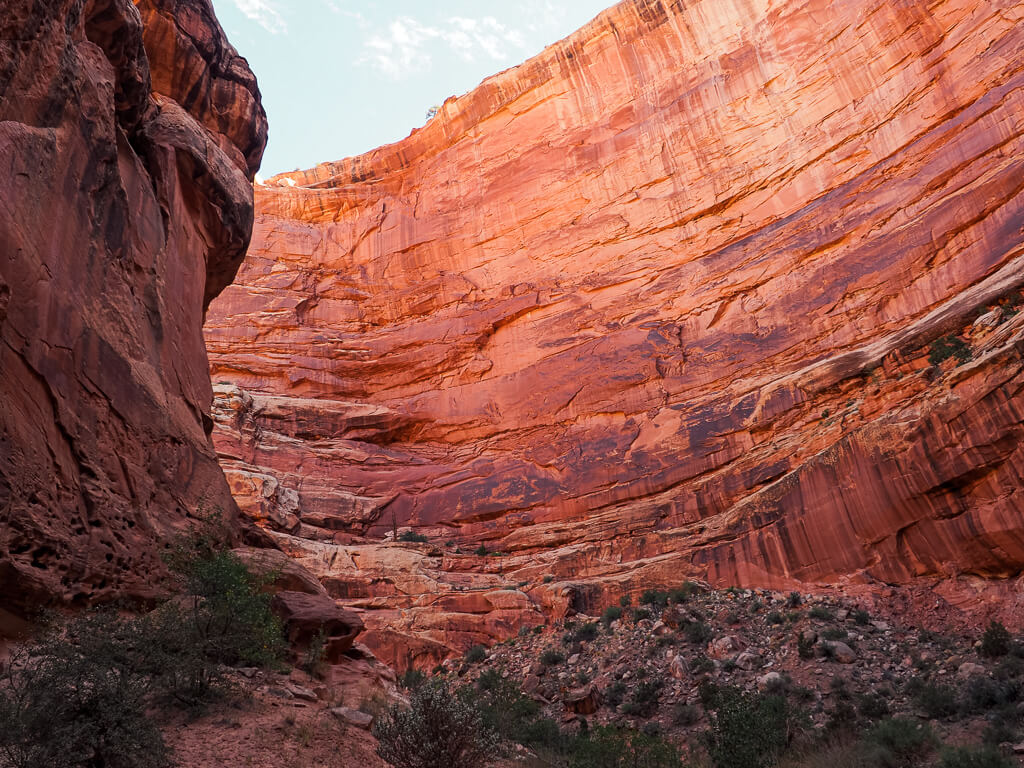
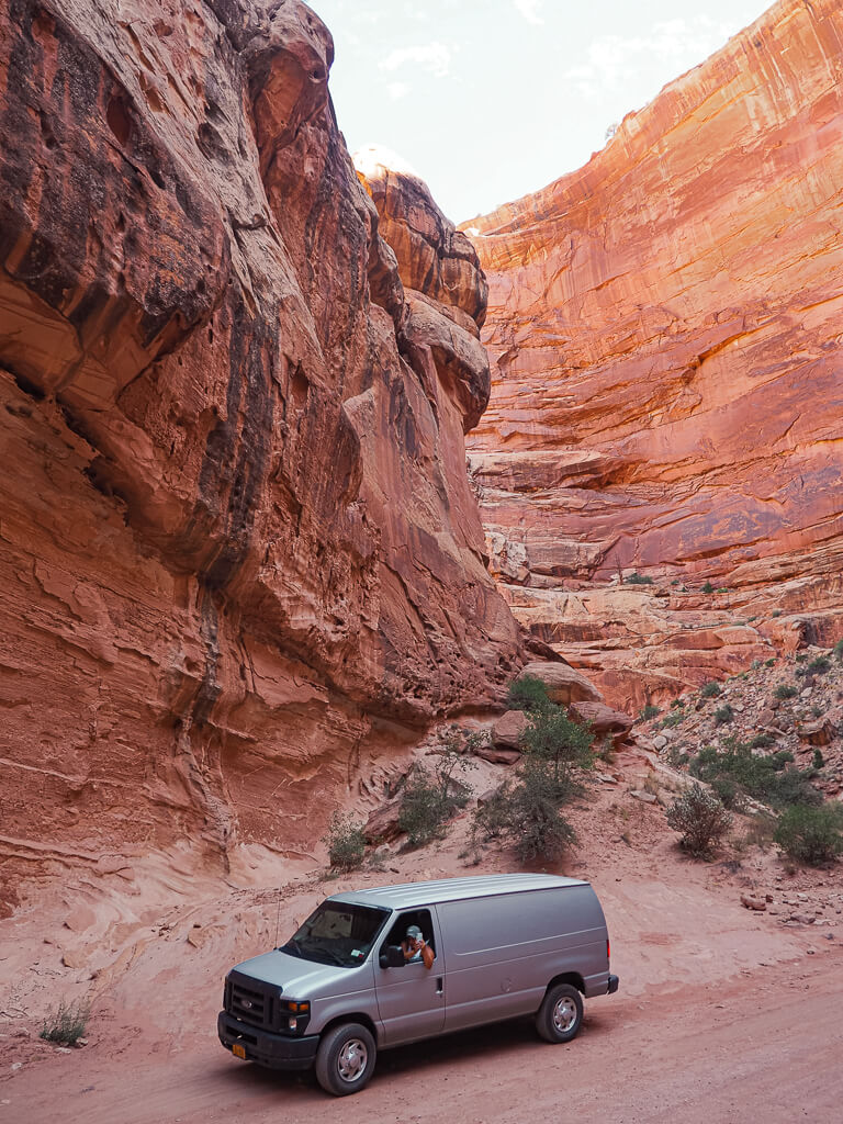
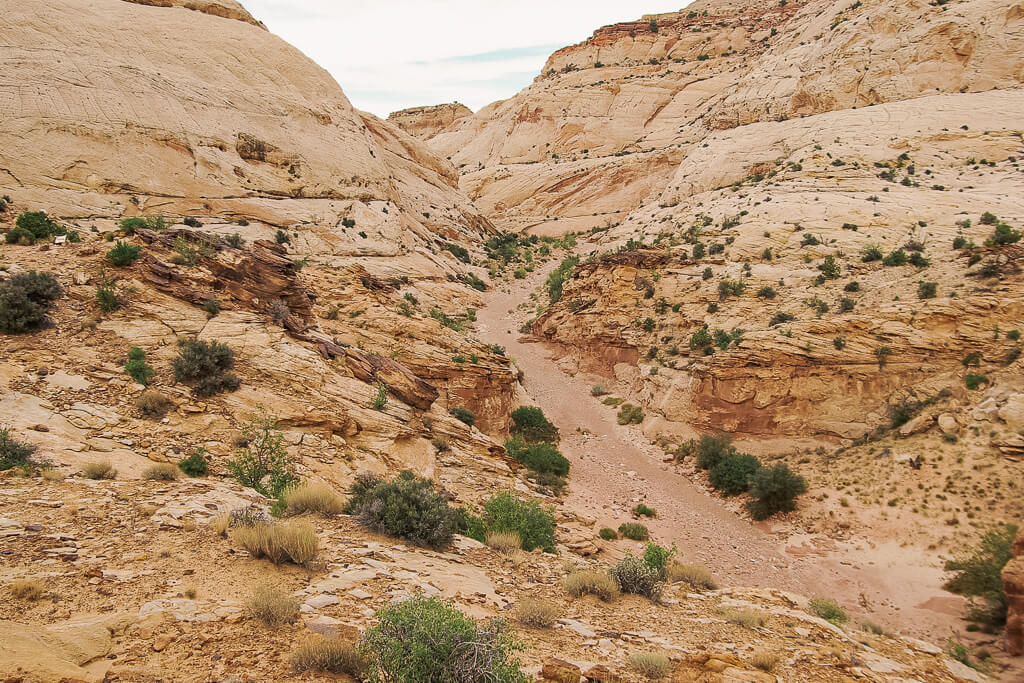
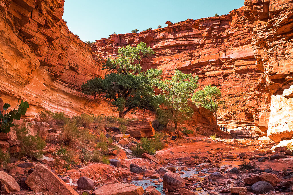
3. Grand Wash
Difficulty: Easy
Length: 6.9 miles or 4.4 miles
Type of Hike: Out and back
Elevation Change: 200 ft
Trailhead: Start at either Capitol Reef Scenic Drive or Highway 24
Entrance Fee: Depending on the trailhead you start at
Time: Varies
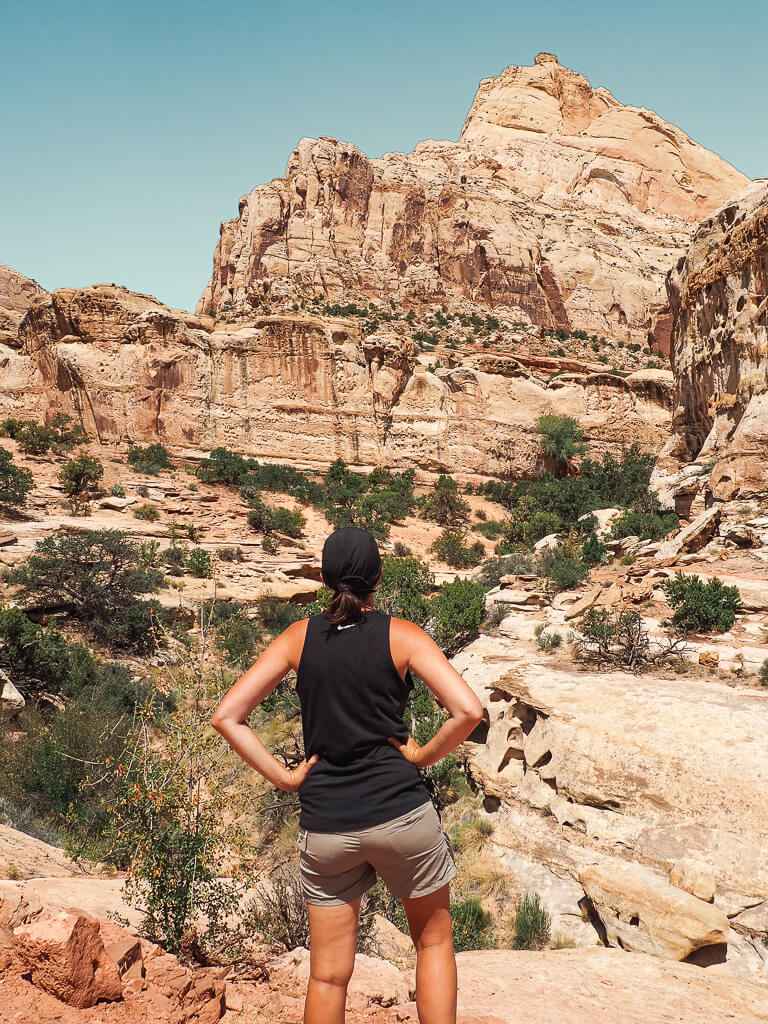
Grand Wash is another famous gorge in Capitol Reef National Park that carves its way through the upper portion of the Waterpocket Fold.
You have different options for hikes in Capitol Reef within this area of the park:
Take the Grand Wash Trail via Capitol Reef Scenic Drive (6.9 miles) to hike the whole distance from the Scenic Drive to Highway 24. Or just hike a part of Grand Wash via Northeast Trailhead, starting at Highway 24 (4.4 miles).
Grand Wash is one of the most popular and best hikes in Capitol Reef, which is loved by younger and older visitors. The trail is easily accessible and relatively flat, but it offers great opportunities to explore the dry wash bed with towering cliffs and narrowing canyon walls.
Top Tip: On both of the trails, you pass the trailhead to the famous Cassidy Arch. When you are up for another moderate to strenuous 3.4 miles to see a beautiful natural arch, don’t miss your chance.
4. Fremont River
Difficulty: Moderate
Length: 2.0 miles
Type of Hike: Out and back
Elevation Change: 480 ft
Trailhead: Fremont River Trail Parking Area, right behind the Visitor Center
Entrance Fee: Yes
Time: 1 – 2 hours
Enjoy a perfect combination of an easy stroll and a tough uphill ascent to fantastic views overlooking the Fruita Historic District. The trail begins by meandering along a densely vegetated riverbank, before climbing up past the colorful layers of rock above the river bed. Take your time as you get higher to admire the outstanding landscape of the Fremont River Gorge, the Waterpocket Fold, and the surrounding landscape of Capitol Reef National Park.
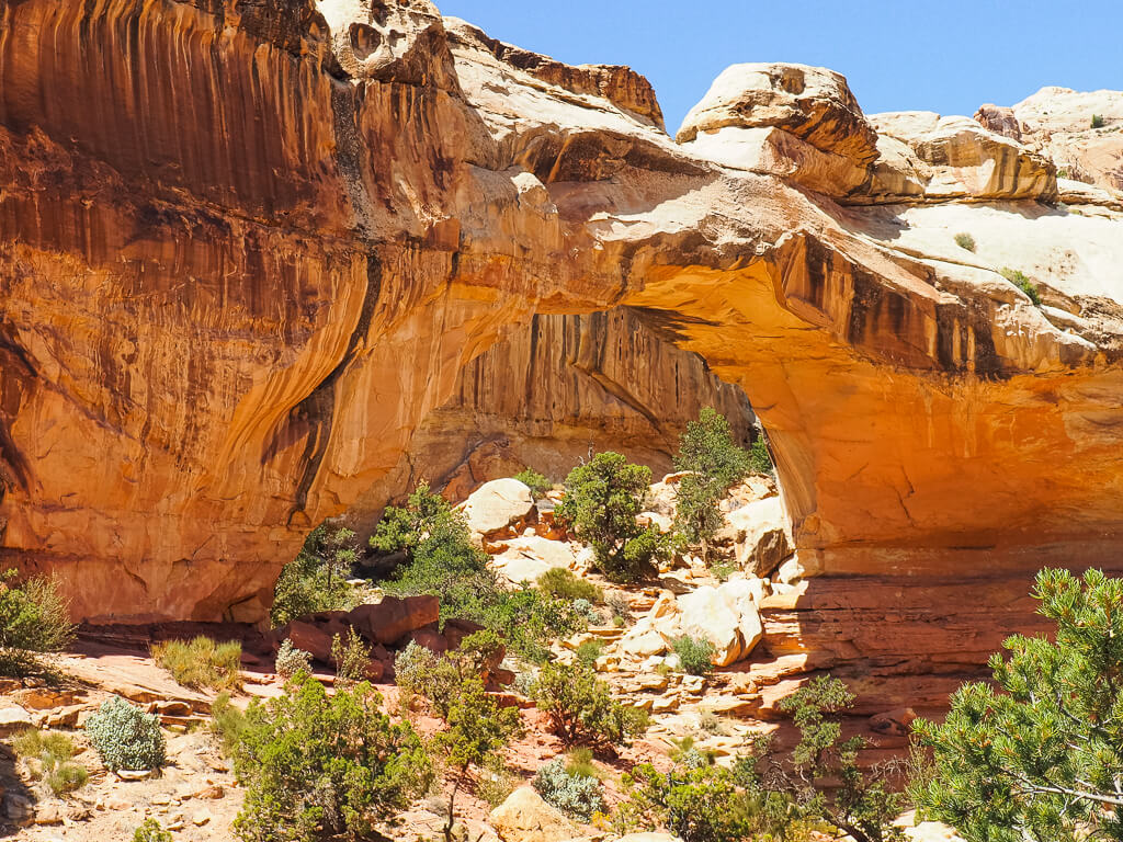
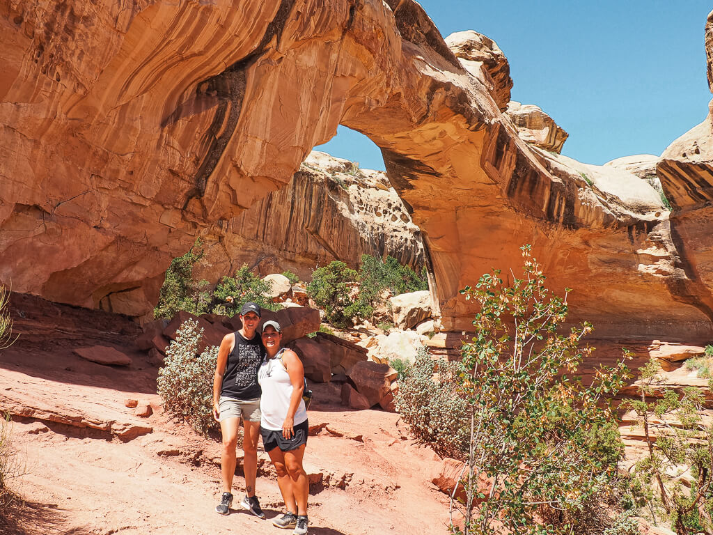
5. Hickman Bridge
Difficulty: Moderate
Length: 1.8 miles
Type of Hike: Out and back
Elevation Change: 400 ft
Trailhead: Parking Lot off of Highway 24 for the Hickman Bridge Trail
Entrance Fee: No
Time: 2 – 3 hours
This trail offers views of one of the better-known sites in Capitol Reef, the Hickman Bridge. This natural arch sits at an incredible height of 300 feet but shockingly does not surpass the surrounding cliffs of the Waterpocket Fold. To really get a feel for the size of the natural arch, the route leads you underneath Hickman Bridge, providing fantastic photography opportunities.
It is also one of the more popular and best hikes in Capitol Reef National Park.
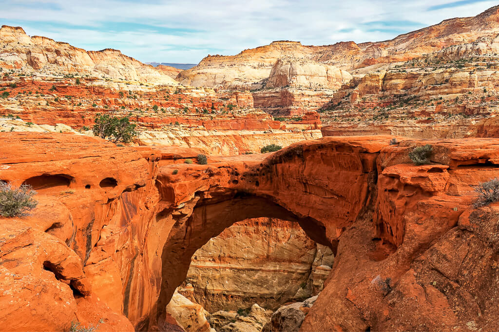
6. Cassidy Arch
Difficulty: Strenuous
Length: 3.4 miles
Type of Hike: Out and back
Elevation Change: 670 ft
Trailhead: Drive the Grand Wash Road to the end of the parking lot
Entrance Fee: Yes
Time: 2 – 3 hours
Cassidy Arch is located on the walls of Grand Wash, aside from the Capitol Reef Scenic Drive. The arch is named after Butch Cassidy, who was a well-known outlaw and train robber, who had a hideout in Grand Wash.
To reach the arch you will need to take a left at the Frying Pan Trail junction and follow the marked trail. At the end of the trail, you will have a perfect view of the spectacular arch from above, sitting 400 feet above the Capitol Reef Scenic Drive. Unfortunately, there are no marked trails to get to the base. Due to the elevation gain, the trail is a little strenuous but you will get rewarded with excellent photo opportunities from above.
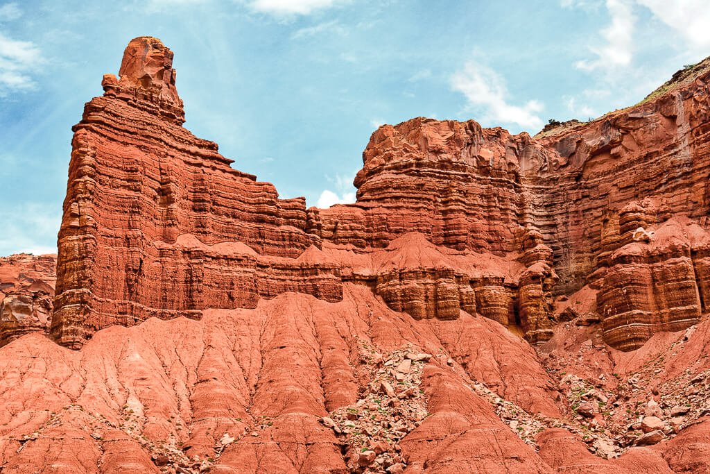
7. Chimney Rock
Difficulty: Strenuous
Length: 3.6 miles
Type of Hike: Loop
Elevation Change: 590 ft
Trailhead: Parking Area on Highway 24
Entrance Fee: No
Time: 2 – 4 hours
Take the climb to a low mesa, raised above Mummy Cliffs, to overlook the Chimney Rock, a natural spire formation rising over 300 feet. Many years ago, Chimney Rock was also a part of the Mummy Cliffs but erosion has separated it from the cliffs.
This is an unshaded trail, so it is best not to hike in the hot midday sun when you visit during the summer. The plus side to hiking this trail in the latter part of the day is viewing the dramatic colors of the landscape just before sunset.
8. Navajo Knobs
Difficulty: Strenuous
Length: 9.4 miles
Type of Hike: Out and back
Elevation Change: 1,620 ft
Trailhead: Hickman Bridge Trailhead, off of Highway 24
Entrance Fee: No
Time: 5 – 7 hours
This hike is much different from the other Capitol Reef hikes, as it brings you high above the Fruita Valley, providing a different perspective of the park. It is the longest maintained Capitol Reef National Park hiking trail with the highest elevation. The start and end of the trail are at the Hickman Bridge Trailhead.
If you don’t want to hike the whole trail, a very popular point to turn around is Rim Overlook. You will reach Rim Overlook almost halfway through Navajo Knobs (after around 4.1 miles). Those continuing on to Navajo Knobs prepare for the steepest climbs of the hike.
This trail is also unshaded, so make sure you are mindful of the heat during the hotter times of the year.
9. Golden Throne
Difficulty: Strenuous
Length: 4.0 miles
Type of Hike: Out and back
Elevation Change: 730 ft
Trailhead: End of Capitol Gorge Road
Entrance Fee: Yes
Time: 3 hours
Explore one of the lesser-used Capitol Reef hikes on the Golden Throne Trail. This mountain, soaring 1,400 feet from the bottom of the gorge, is a prominent feature of Capitol Reef National Park and a popular photo spot.
The trail to Golden Throne will have you climbing the collapsing cliffs of Capitol Gorge, so you will quickly gain significant elevation. From the road up, a series of switchbacks will lead you to the Golden Throne viewpoint.
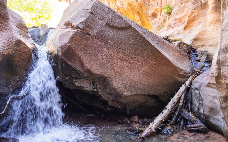
10. Sulphur Creek
Difficulty: Difficult
Length: 5.8 miles
Type of Hike: One way
Trailhead: Parking area just west of the Chimney Rock Trailhead on Highway 24
Entrance Fee: No
Time: 4 – 5 hours
Hiking in Capitol Reef’s Sulphur Creek is one of the most unique Capitol Reef National Park hiking experiences in the park. Sulphur Creek has carved out a profound canyon, which has exposed some of the oldest rock layers in Capitol Reef.
Surrounded by narrow canyon cliffs and waterfalls, you will trek through the water of various depths. The trail from the Highway 24 trailhead to the Visitor Center is not an official or maintained trail, so expect challenges from weather, flash floods, rock falls, and other conditions. You should have skills in route finding, map reading, and navigation.
Top Tip: If you are interested in hiking through a canyon filled with water, you may also enjoy hiking The Narrows in Zion National Park.
Capitol Reef National Park Hikes Map
Additional Hikes in Capitol Reef: Fruita Area
Believe it or not, there are still more best hikes in Capitol Reef National Parks to do in the lower section of the park. Some of these trails can even be combined with our top ten hikes in Capitol Reef.
More Easy Capitol Reef Hikes
Goosenecks (0.2 miles) – A very short, easy trail with sensational canyon views. This trail can easily be combined with the Sunset Point Trail.
More Moderate Capitol Reef Hikes
Cohab Canyon (3.4 miles) – This trail has a lot to see, from dramatic rock formations to hidden canyons, and scenic viewpoints looking over the valley.
More Strenuous Capitol Reef Hikes
Fremont Gorge Overlook (4.6 miles) – A steep climb leading you to a gorgeous viewpoint, overlooking the canyon and the surrounding area.
Frying Pan (5.8 miles) – A point-to-point trail connecting the Hickman Bridge Trail to Cohab Canyon to Grand Wash.
Old Wagon Trail Loop (3.8 miles) – This trail is unlike all the other Capitol Reef hikes. On this one, you will meander through a pinyon-juniper forest as you hike up Miners Mountain. Enjoy views of the Waterpocket Fold and the Henry Mountains.
Rim Overlook (4.6 miles) – The longest maintained trail in Capitol Reef National Park with panoramic views of the Fruita Valley and Waterpocket Fold.
Alternative Activities in Capitol Reef National Park
Even though hiking is the best way to explore Capitol Reef National Park’s landscape and the special feature, the Waterpocket Fold, there are still more activities, you don’t want to miss on your visit.
These are the things you have to put on your Capitol Reef bucket list:
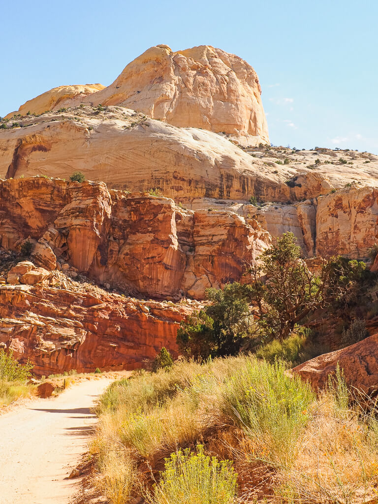
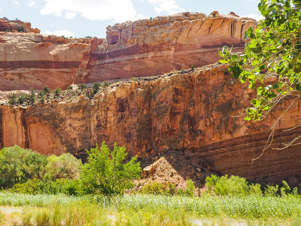
1. Tour the Capitol Reef Scenic Drive
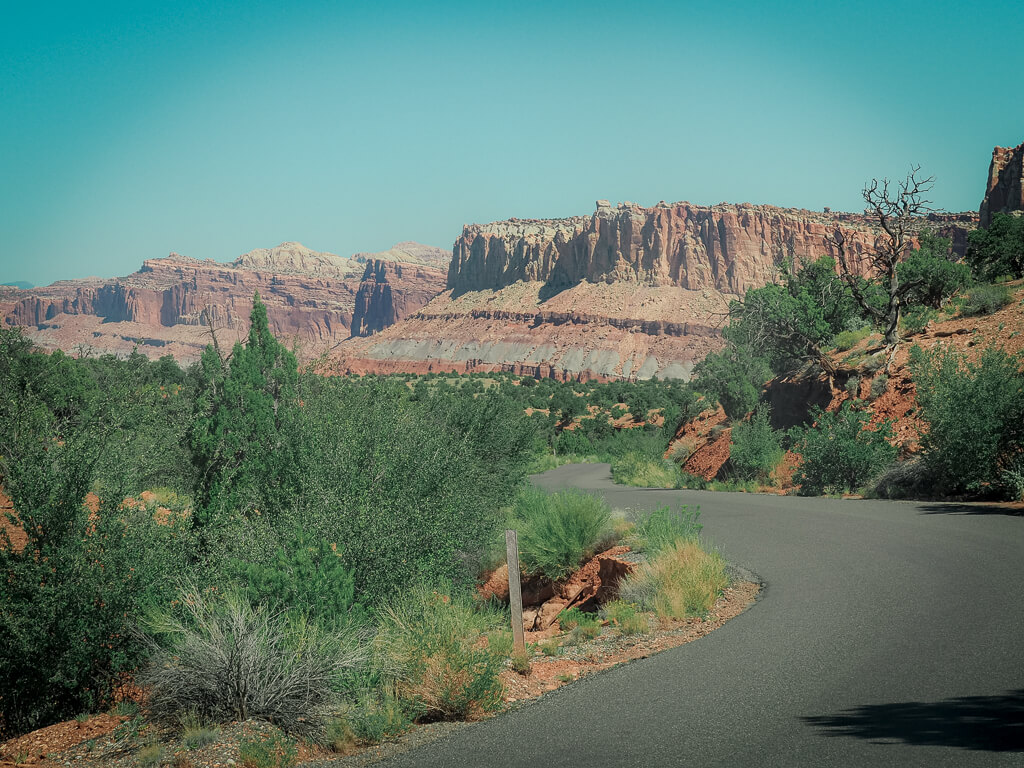
The Capitol Reef National Park Scenic Drive is 7.9 miles long and will take you around 1.5 hours to complete. It is a paved, easily traveled road with 2 spur dirt roads, Grand Walsh and Capitol Gorge. Both of the dirt roads are accessible for all passenger vehicles and RVs up to 27 feet in length. Due to the risk of flash floods, these roads are closed in bad weather.
Make sure to stop at some of the 11 scenic points along the Capitol Reef Scenic Drive to get more information about the history and geologic formations of the park. Each stop is marked, which makes it easy to find them.
Some of our favorite stops in Capitol Reef National Park are:
Stop 1 – Moenkopi Formation: An impressive formation of different grey and reddish-colored layers, which contains volcanic ash.
Stop 3 – Grand Wash: A dirt road that leads you into a steep-walled canyon. Abandoned mines can also be seen on this road.
Stop 4 – Solution Pockets: Admire the differently-shaped cavities in the sandstone cliffs.
Stop 9 – Capitol George: This dirt road is longer and more winding than Grand Walsh. If you get the chance to drive there, you will be rewarded with narrow twists through the sandstone.
Stop 10 – Navajo Formation: This white, rounded dome gave this National Park the first part of its name. It looks like the US Capitol Building in Washington D.C.
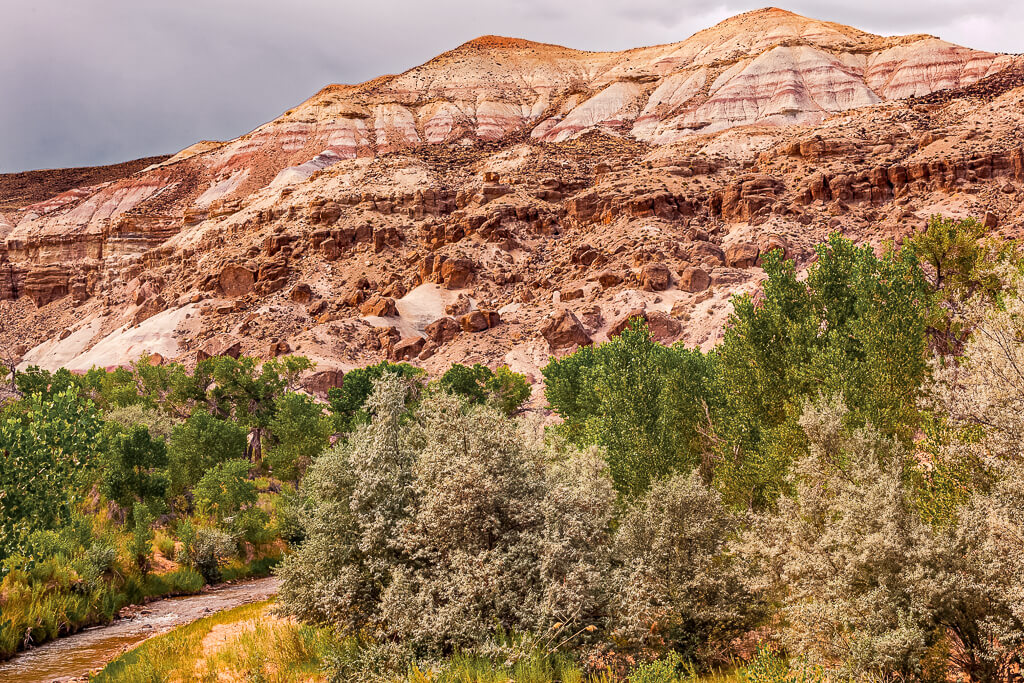
2. Visit the Fruita Historic District
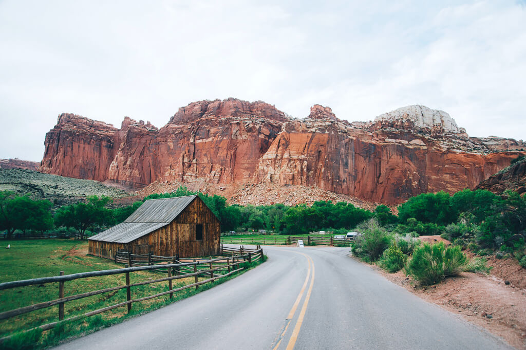
The Fruita Historic District is considered the center of Capitol Reef National Park. Long before this area was established as a national park, the valley was home to a small community, that relied on the Fremont River to survive.
Besides the Capitol Reef Scenic Drive and hiking the trails, here are other things to do in the Fruita District:
Gifford House
Get to know more about the early Mormon settlers in the Fruita Valley by visiting the Gifford House, a typical 1900’s Utah farmhouse. Originally, it was home to the Gifford Family who lived in it for more than 40 years. They were the last residents of Fruita Valley, before selling their home to the National Park Service in 1969.
Stop in to just check out the house, purchase unique gifts, or grab one or two of their delicious sweets.
We purchased a fruit pie and enjoyed it out on the grass in front of the Gifford House, taking in the scenery of the Fruita Valley.
Fruit Orchards
Another unique feature of Capitol Reef National Park is the fruit orchards. Depending on the time of year, there are different fruits that you are welcome to pick in the orchards. The best way to find out about the fruit orchards that are open for picking is to get information at the Visitor Center. The orchards will have a sign posted, “open for picking.”
You are only allowed to pick fruits in open orchards. Please always be mindful and respectful of the orchard regulations. The fruit that you consume in the orchard is free.
However, any fruit that you take from the orchard must be paid for at the self-pay stations. The price of the fruit is listed at the entrance of the orchard. At the self-pay station, you will find a scale and plastic bags for you to measure your fruit. This is such a unique experience you won’t find at other national parks.
Here is a list of the flowering and harvest times for the fruits that you can find in Capitol Reef:
| FRUIT | FLOWERING | HARVEST |
| Cherries | Late March to Mid April | Mid-June to Early July |
| Apricots | Early March to Mid April | Late June to Mid-July |
| Peaches | Late March to Late April | Late July to Early September |
| Pears | Late March to Early May | Early August to Early September |
| Apples | Early April to Early May | Mid-August to Mid-October |
3. Admire the Petroglyph Panel
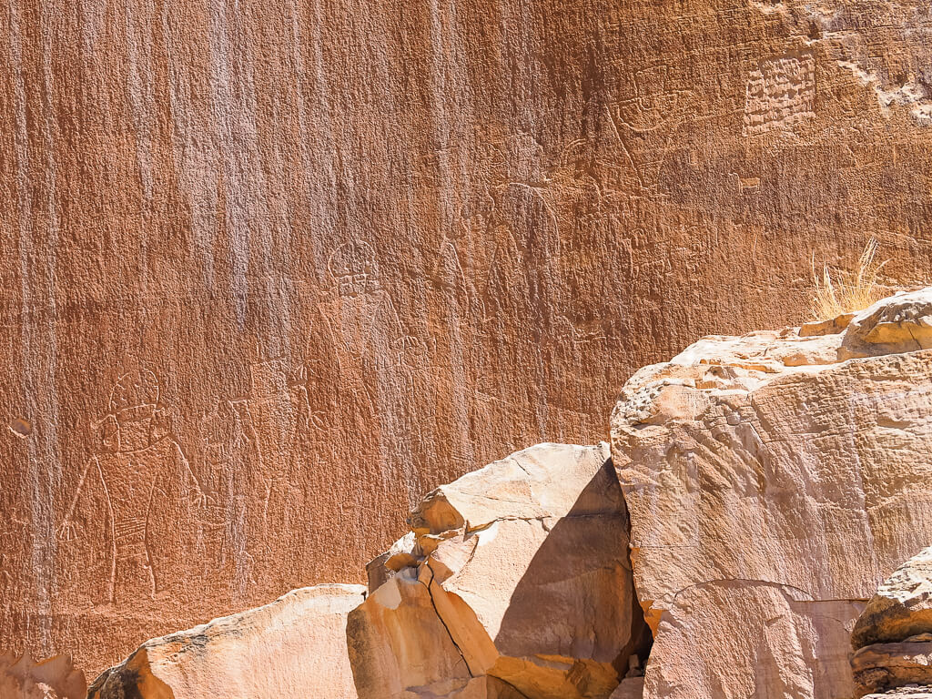
These petroglyphs date back to the Fremont culture that existed in the Utah area. The Petroglyph Panel is located on the rock panels of the cliffs that run parallel to Highway 24. There is a small turnout with a boardwalk leading you to the petroglyphs.
Take your time as you walk along the pathway, some petroglyphs are very hard to see. We walked right by some and were getting a little disappointed because we expected to see more. But once we started seeing them, it was like they all started popping out at us.
Wonder what these petroglyphs mean? Us too! They help tell the story of the Fremont and Ancestral Puebloan people who lived here from 600 – 1300 A.D. Unfortunately, we may not understand everything about what was carved into these rocks, but it gives us an idea of how these people lived and communicated.
What to Pack for Capitol Reef Hikes
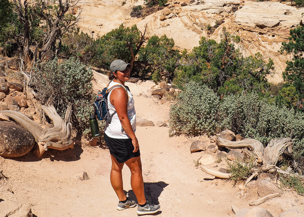
Daypack – For any day hike it is important to have a daypack to carry all of your hiking essentials. Our favorite go-to hiking daypack is the comfortable lightweight Deuter Speed Lite 22.
Basic Day Hiking Essentials – Never head out on a hike without packing the essentials. Basic items you should carry with you on your hikes are plenty of water, snacks, a first aid kit, weather-appropriate clothing, comfortable hiking boots or sandals, navigation/map, and a utility knife (optional).
Water Bottle – Keep your water cool by bringing an insulated water bottle. We always carry our Hydro Flask water bottles with us.
Comfortable Hiking Boots – One of the worst things when heading out for a hike is not having comfortable footwear. For hiking in Capitol Reef, it is best to use over-the-ankle hiking boots because they provide you with good support on the more rocky and difficult terrain.
Camera & Accessories – Don’t forget to pack a camera to capture all the memories you are about to make during your trip to Capitol Reef National Park. Our essential camera gear is our Olympus OMD Em Mark ii, the Rollei travel tripod, a camera remote, and our Peak Design capture clip.
Cash for Gifford House – Don’t forget cash for the delicious fruit pies on sale at the Gifford House. You don’t want to miss out on this yummy snack!
Reusable Bag for Picking Fruits – Pack a reusable bag to have a way to carry all the fruits you picked in the various orchards in the Historic Fruita District.
How Much Time Do You Need at Capitol Reef?
For most of the visitors, 1 to 2 days are sufficient to see and explore the main features on the Capitol Reef Scenic Drive and the part of Highway 24 that runs through the park.
If you are looking to dive deeper into the park’s backcountry, or complete the longer, more strenuous Capitol Reef National Park hiking trails, you will need more time.
We had limited time on our 9 week road trip through the United States, that is why we decided to visit Capitol Reef in one day.
We were able to accomplish the Capitol Reef Scenic Drive by exploring our favorite spots, hiking the Hickman Bridge Trail, visiting the Gifford House, and admiring the Petroglyph Panel.
After visiting, we have to say that we really underestimated the various and unique opportunities this national park offers. We want to come back to explore more of its beauty on other best hikes in Capitol Reef National Park soon.
Tips for Visiting Capitol Reef National Park
1. Start Your Day Early
Get the most out of your visit to Capitol Reef National Park by arriving early. Anytime we visit a national park, we like to have as much time as possible. The upside of arriving early is also to enjoy the views and the best hikes in Capitol Reef National Park with fewer people. The park is open 24 hours, so it allows for lots of flexibility when it comes to spending time in the park.
2. Take a Look at the Weather
Be sure to check the weather before you visit Capitol Reef National Park. Flash floods are not uncommon, especially during the monsoon season from July to September.
However, flash floods can happen at all times of the year. A flash flood can severely impact your trip as it can make traveling through the park very difficult and sometimes even impossible in some areas. Before you decide to hike into any canyon, you should check the forecast for the day.
3. Check the Road Conditions
Check the road conditions within the park, before traveling to Capitol Reef National Park. Road conditions can easily change, depending on the weather. The best way to stay up to date on the roads in the park is to call the park’s automated phone system at (435) 425-3791. Then press 1 for the visitor information and 4 for the road conditions.
Visit the Capitol Reef National Park Service website for more information on what to expect on the roads in the park.
4. Don’t Expect Cell Service
Please be aware, that when you are visiting and exploring the beautiful lands of America’s national parks, you won’t always have cell service. So take advantage of disconnecting from the world and enjoy the landscape around you.
5. Leave No Trace
Please recreate responsibly. Anytime you visit a United States National Park or you are just enjoying the outdoors, it is important to remember to follow the Leave No Trace principles. Respect and appreciate nature, so that future generations can enjoy the same beauty.
Where to Stay in Capitol Reef National Park
Inside the National Park
There are three different camping options available in Capitol Reef Utah. All of them are very basic without showers, individual water, sewage, or electrical hookups.
1. Developed Campground
Fruita Campground is located next to the Fremont River, surrounded by beautiful orchards. There are 71 campsites available. Each site is equipped with a picnic table and fire pit and/or an above-ground grill. Dump and potable water fill stations are located near the entrance to Loop A and B. Restrooms have flushing toilets and running water.
If you would like to stay a night, it costs $20. Reservations can be made 6 months in advance, from March 1 to October 31. From November 1 to February 28, the campground runs on a first come first serve basis.
It is a beautiful and convenient place to stay during a visit to Capitol Reef. Access to the Gifford House, orchards, and Scenic Drive is very easy. If you like staying inside the park, this would be your best option.
2. Primitive Campgrounds
These campgrounds are free. But keep in mind that water is not available and there are only pit toilets to use. Before traveling here, it is best to find out the road conditions by calling 435-425-3791. First, press #1, and then #4 for road conditions.
- Cathedral Valley Campground is located about halfway on Cathedral Valley Loop Road. However, to access this campground you will need a high clearance four-wheel-drive vehicle.
- Cedar Mesa Campground is located on Notom Bullfrog Road. Normally, a two-wheel drive is able to reach the campground. However, high clearance is sometimes needed.
3. Backcountry Camping
Capitol Reef Utah has great opportunities for backpacking trips. If you want to venture out into these remote areas, you will need to obtain a backcountry permit. The permit is free and easily picked up at the Visitor Center.
Outside the National Park
There are many camping opportunities in close proximity to the park. On top of that, Utah has tons of BLM lands and National Forests for dispersed camping. Those dispersed camping areas are free of charge.
If you are looking for a little more upscale than camping, the closest hotels are about 7 miles from the park. These are our three favorite hotel accommodations:
Where We Stayed: Capitol Reef Overflow
We traveled to Capitol Reef National Park during our road trip through the United States with our campervan we always tried to find a free place to stay for the night. At Capitol Reef National Park we were in luck!
There is an awesome free place, Capitol Reef Overflow, right outside the park entrance in the Fishlake National Forest. It is located on the west side of the park, near Torrey, Utah. Get reviews, and the full description to find our exact spot on Campendium.
We loved Capitol Reef Overflow. It was extremely easy to find, and easily accessible since it is seen off of Highway 24. There were a few other campers staying the night as well. Some were in RVs, while others pitched a tent for the night. It is always great to find a free spot with incredible views close to your destination. You can’t ask for anything better when you are on the road.
Is Capitol Reef Worth Visiting?
After visiting all of the Mighty 5 national parks in Utah, we can easily say Capitol Reef National Park is totally worth it. Capitol Reef is the least visited, and probably the most underrated national park out of the Utah Mighty 5 but it is no less magnificent than the others. There are so many unique features and hidden gems in the park. We personally loved our visit to Capitol Reef and would have loved additional time to explore the park more in-depth.
Quick Overview of the Best Capitol Reef Hikes in the Fruita District
- Sunset Point
- Capitol Gorge
- Grand Wash
- Fremont River
- Hickman Bridge
- Cassidy Arch
- Chimney Rock
- Navajo Knobs
- Golden Throne
- Sulphur Creek
Which Capitol Reef hikes did you find the most outstanding? Which other activities did you do in the park?
Share your experiences with us or drop a question in the comments below!
Our Other Resources for Utah’s National Parks:
- ARCHES: 8 Incredible Trails to Hike Arches National Park
- BRYCE CANYON: Best Bryce Canyon Hikes for Your Bucket List
- CANYONLANDS: The Best of Island in the Sky Canyonlands National Park
- ZION: 11 Best Hikes in Zion National Park
- ROAD TRIP: Explore Utahs National Parks in One Unforgettable Road Trip
- ROAD TRIP: Plan a Trip from Zion to Bryce Canyon: 2 Utah National Parks
You May Also Like:
- HIKING: 15 Most Helpful Hiking Apps to Download
- HIKING: What You Should be Packing for a Hike: The Essentials + Extras
- HIKING: 100+ Best Gifts for Hikers to Buy
- NATIONAL PARK: 16 Best East Coast National Parks You Need to Visit
- NATIONAL PARK: 34 Best West Coast National Parks + Western U.S. Parks that Will Blow You Away
- NATIONAL PARK: A Complete National Park List by State + Downloadable Checklist and Map
- NATIONAL PARK: First Hand Ranking of National Parks in the USA from Best to Worst
Save this Post for later on Pinterest!
Did you like this post? Subscribe to our newsletter and we’ll send you more unique travel tips, updates, and even FREE content!

Thanks for this post! We are planning a weekend trip to Capitol Reef in September and this was really helpful.
You will love it. We are very happy we could share our experience with you for your trip.