19 Best Hikes in Sedona You Don’t Want To Miss
Heading to Sedona, Arizona? Then be prepared to be amazed on the several hikes in Sedona.
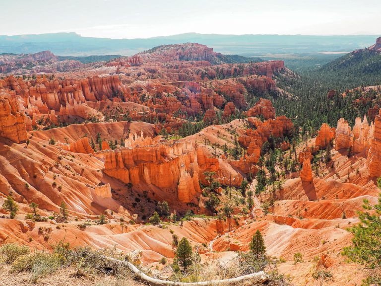
Sedona is a hiker and outdoor adventurer’s dream destination. It is home to undeniably beautiful red rock formations and some of the most gorgeous and exciting hiking trails in the United States. The best way to capture the natural beauty is by wandering along the diverse hiking Sedona trails. But which one should you take?
With the unlimited opportunities for outdoor adventures, we have created a list of our favorite hiking trails in Sedona. There is no doubt all of these hikes Sedona has to offer will instantly captivate you with stunning panoramic views, secret caves, and fascinating desert landscape.
Sedona is also one of the most well-known places in the world to find energy vortexes. It is believed these swirling centers of energy help us heal, meditate and explore ourselves. Curious what it feels like to hike through an area where the vortex energy is very high? Then don’t miss out on our favorite vortex hikes Sedona.
In this post, we will cover multiple hikes in Sedona in detail with trail statistics, their best features, what to expect, and tips for the trail. We also wrote in-depths guides for some of those Sedona hike trails you have to read before you start your adventure in Sedona.
What are you waiting for? Let’s get to the best Sedona hiking trails!
Our Other Resources for Sedona:
- 17 Best Things to Do in Sedona, Arizona
- How to Hike the Stunning Devils Bridge Sedona Trail
- Soldiers Pass Trail: How to Find the Hidden Cave
- Hike Cathedral Rock Sedona: The Complete Guide
- Finding the Secret Birthing Cave Sedona
This post may contain affiliate links. If you make a purchase through them, we get a small commission at no extra cost to you. It helps us create free content for you to enjoy. Learn more about our disclaimer here. Thanks for your support!
What to Bring: Top 5 Hiking Essentials
Insulated Water Bottle: We found out very quickly that having a good insulated water bottle makes a world of difference on our hiking trips. l Hydro Flask
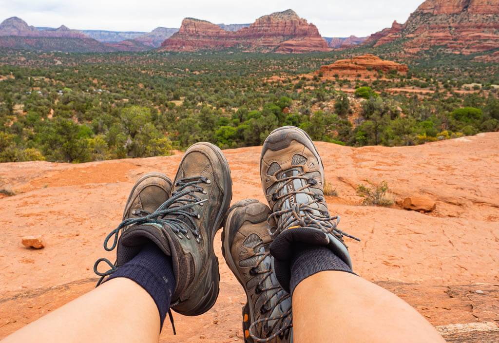
Durable Hiking Footwear: Hiking on different terrain requires sturdy hiking boots you can trust. We totally count on the Newton Ridge Plus Waterproof Hiking Boot. l Columbia
Comfortable Hiking Socks: Trust us, a quality hiking sock with a good cushion can make a huge difference in how your feet will feel after any hike. l Darn Tough
Photography Gear: Peak Design with its many smart photography accessories makes capturing our adventurous hiking moments so much easier. l Peak Design
Read the Full Guide: What You Should be Packing for a Hike: The Essentials + Extras
Where is Sedona?

Sedona is centrally located in the state of Arizona in the southwest region of the United States. It lies within the Coconino National Forest, one of the most diverse National Forests in the United States.
SEDONA DRIVING DISTANCES:
Flagstaff, Arizona – 45 minutes
Phoenix, Arizona – about 2 hours
Tucson, Arizona – 3 hours 30 minutes
Petrified Forest National Park, Arizona – about 2 hours 30 minutes
Grand Canyon National Park, Arizona – about 2 hours 20 minutes
Las Vegas, Nevada – about 4 hours 30 minutes
Joshua Tree National Park, California – about 5 hours
Zion National Park, Utah – about 5 hours
Best Hikes in Sedona AZ You Don’t Want to Miss
Sedona is one of our favorite hiking destinations in the United States. Hikes in Sedona are spectacular and offer stunning vistas and unique gems on every trail. You can’t go wrong with any of them. So just pick a couple of them or all of them and get out on the trails in Sedona.
But before you start your red rock adventure, there is one piece of advice we would like to share with you.
Make sure you know when you need a Red Rock Pass. It is your permit to do some of the best hiking in Sedona. Learn more about the Red Rock Pass below.
Easy Hikes in Sedona Arizona
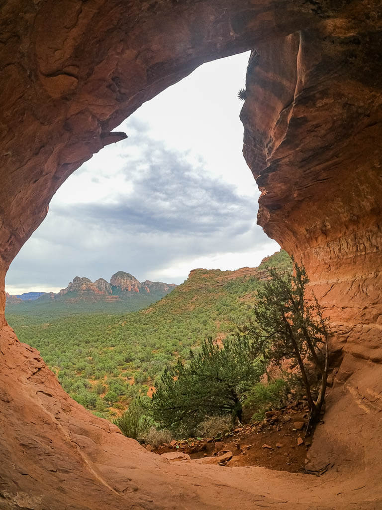
1. Birthing Cave – Long Canyon Trail (No. 122)
BIRTHING CAVE TRAIL STATISTICS:
Difficulty: Easy
Length: 2 miles
Type of Hike: Out and Back
Time: 1.5 to 2 hours
Elevation: About 300 ft
Location: Long Canyon Road
Trailhead: Long Canyon Trail Sedona
When to Hike: Sedona hiking trail, Birthing Cave Sedona is great all year long.
Permit Required: No
The trail to the Birthing Cave is one of the easy hikes in Sedona. At the end of the trail you get rewarded with a unique cave overlooking the gorgeous Sedona red rock landscape.
The whole path to the Birthing Cave is mainly wide, flat, and consists of loosely packed red dirt for the majority of the way until you reach the Birthing Cave Sedona.
To get to the Birthing Cave, you will start out on Long Canyon trail for roughly 0.5 miles. At this point, you will reach a fork in the trail. Here you will want to head left on the lesser-traveled path heading towards the towering red cliffs in the distance. As long as you see the red cliffs in front of you and NOT on the side of you, then you know you made the right turn.
This quaint trail will bring you to the base of the Birthing Cave. As you approach the red cliffs, you will be able to see the Birthing Cave appear. Once you have made it here, you will have a little climb and rock scramble to get inside the cave. You can do it.
Now that you have made it into the cave, turn around and check out the amazing views of Sedona’s red rock landscape.
Top Tip: The Sedona hiking trail to the Birthing Cave might be a breeze but finding the Birthing Cave is a little trickier. So we thought it would be good to put together a step-by-step guide to the Birthing Cave to help you along the way.
BIRTHING CAVE TRAIL FEATURES:
- The Birthing Cave itself, of course!
- Beautiful views of the Sedona area
TIPS FOR BIRTHING CAVE
1. Limited Parking – Parking is very limited. There is not a true parking lot for this hiking in Sedona trail but you will find spots along the road and in front of the trailhead.
2. Finding the Birthing Cave – Don’t try to find the cave without being prepared. We met so many hikers who got lost because they started the trail without having a clue where to go. Follow these easy directions to get to the cave without getting lost.
3. Bring a Wide-Angle lens – If you love photography, you want to pack a wide-angle lens. Then you can capture the entire beauty of this uniquely shaped cave in your pictures. We brought our GoPro Hero 8 and were super satisfied with the outcome of our pictures.
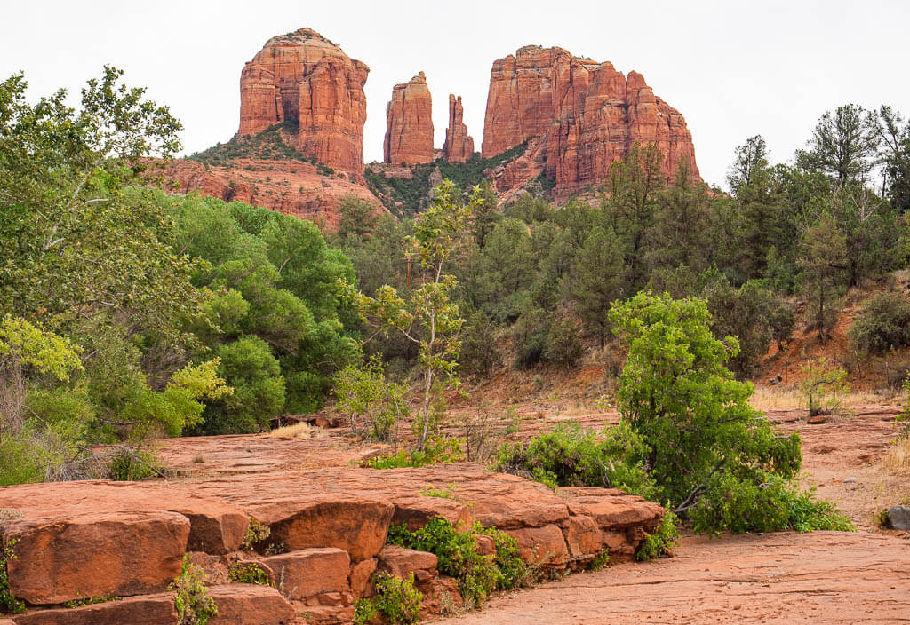
2. Red Rock Crossing
RED ROCK CROSSING TRAIL STATISTICS:
Difficulty: Easy
Length: 1.1 miles
Type of Hike: Out and Back
Time: About 1 hour
Elevation: Very Little
Location: Crescent Moon Day Use Area or Verde Valley School Road
Trailhead: Crescent Moon Picnic Site or Baldwin Trailhead
When to Hike: This hike in Sedona is great all year round.
Permit Required: Yes, you will need a Red Rock Pass or Annual National Park Pass when you park at the Baldwin Trailhead. To visit the Crescent Moon Day Use Area, you will have to pay a day-use fee of $9 per vehicle or a $2 walk-in fee per person.
The Red Rock Crossing trail may not be one of the more exciting hiking trails in Sedona but it is still pretty cool to check out.
Most hikers will complete this Sedona trail as a means to see Cathedral Rock for the sunset or as an alternative to starting the Cathedral Rock hike from another trailhead due to parking issues at the official parking lot on Back O Beyond Road.
We found ourselves at this Sedona trail from a local’s recommendation. She praised this hike in Sedona for hot summer days because it is a little hidden gem in the area. Since Oak Creek will be right next to you, you can take a refreshing dip in the water while catching a peaceful sunset behind Cathedral Rock.
RED ROCK CROSSING TRAIL FEATURES:
- Perfect view of Cathedral Rock, especially for sunset
- Swim in Oak Creek
- Family friendly hiking trails in Sedona
- Best hiking in Sedona on hot days
TIPS FOR RED ROCK CROSSING TRAIL:
1. Pack a swimsuit and towel – What’s better than cooling off in the water after a day of hiking Sedona? Locals love this easily accessible place to take a swim with an epic view.
2. Hike for sunset – Looking to capture a perfect sunset photo? Many photographers set up their tripods before sunset to catch Cathedral Rock glowing in the sun. Go early to reserve your spot.
3. Bell Rock Trail
BELL ROCK TRAIL STATISTICS:
Difficulty: Easy
Length: 0.75 miles
Type of Hike: Out and Back
Time: 1 to 1.5 hours
Elevation: About 210 ft
Location: Parking lot of off HWY 179
Trailhead: Bell Rock Trailhead
When to Hike: This hike in Sedona is great all year round.
Permit: Yes
Bell Rock is a well-known Sedona red rock formation. It is obviously named Bell Rock for its bell-like shape. If you are looking for an easy hike in Sedona, put this one on your list. It has great views, is perfect for families, plus offers one of the easiest accessible Sedona vortexes.
It is believed a vortex in Sedona can help us heal, meditate, rejuvenate, reconnect, and explore ourselves. The best way to interact with the earth’s energy is to be in or in close proximity to a vortex. Don’t be surprised to see people doing yoga or meditating at these sites in hopes to feel the powers of the vortex.
The Bell Rock trail climbs the north side of Bell Rock. You are able to ascend the rock formation as high as you would like or feel comfortable. Just make sure it is safe to do so. While on the trail, don’t forget to turn around once in a while to admire the lovely views of Sedona.
BELL ROCK TRAIL FEATURES:
- Vortex Sedona hike
- Picturesque views of red rock formations
- Variety of desert plants
- Family friendly Sedona hiking trails
TIPS FOR BELL ROCK TRAIL:
1. Stay on the trail – Be aware of where you are on the Sedona trail by following the basket cairns. At one point, you won’t be able to see cairns anymore. Instead of making your own way up, try to follow other hikers to avoid damaging the vegetation as much as possible.
2. Be Respectful of other hikers – Bell Rock is a spiritual location where you can feel radiating energy. Find the trees with their twisted trunks along the trail, which symbolizes the swirling of the earth’s energy. Always respect others’ search to feel the powers of the vortex on this Sedona hike.
3. Extend your adventure – Want to spend more time in the area? In addition (or instead) of climbing Bell Rock, you can take the loop surrounding it. Connect the Bell Rock Pathway Trail, the Rector Connector, and the Courthouse Butte Trail for an easy 1.8 miles of exercise. You can also be creative and extend your Sedona hike even more.
Moderate Best Hikes in Sedona Arizona
4. Cathedral Rock Trail (No. 170)
CATHEDRAL ROCK TRAIL STATISTICS:
Difficulty: Moderate
Length: 1.4 miles
Type of Hike: Out and Back
Time: 40 to 60 minutes
Elevation: About 700 ft
Location: Back O Beyond Road
Trailhead: Cathedral Rock Trailhead (No.170)
When to Hike: The best time to hike the Cathedral Rock trail Sedona is in spring and fall, early in the morning.
Permit: Yes, you will need to display a Red Rock Pass or Annual National Park Pass in your windshield for parking.
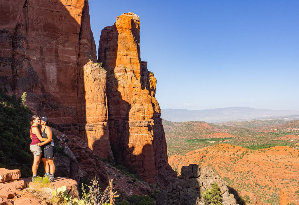
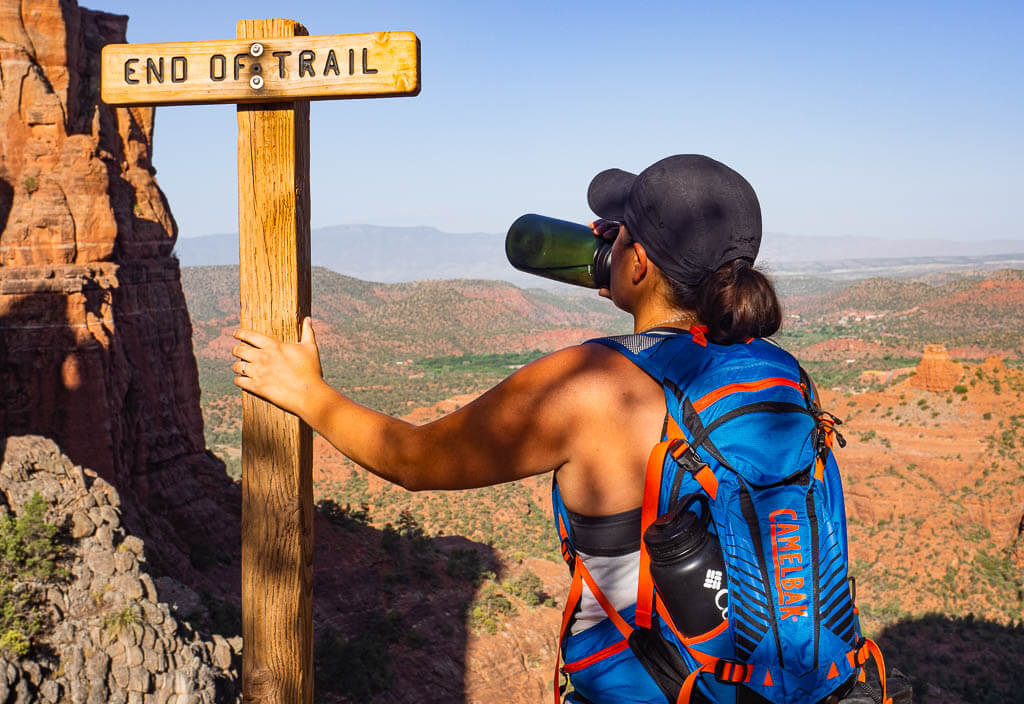
The trail up Cathedral Rocks is a pretty short trip, about 0.7 of a mile (one way). But don’t underestimate it. It is a steep one that involves a little rock scrambling. It is well known Sedona hike for its energy vortex.
Before you start your Cathedral Rock Sedona hike, stop at the trailhead for a second and look up ahead at Cathedral Rocks. Can you spot all the tiny hikers along the trail? Soon you will be one of them.
As you begin your hike to the top, you will quickly realize the trail can be a little hard to find at times. To ensure you are staying on the trail, keep a lookout for the cairns. The cairns on the Sedona trails are the large wire baskets filled with rocks.
You can count on beautiful views during the entire hike, so don’t forget to stop along the way to admire the beautiful red rocks landscape, desert plants, wildlife, and snap a photo of everything. Plus this gives you a reason to take a quick rest, catch your breath, and take a sip of water.
Then just keep climbing until you see the sign that says “End of Trail.” You have now made it to the top of the Cathedral Rock hike Sedona.
Top Tip: For a more exclusive guide to the Sedona hiking trail, Cathedral Rock, read our “How to Hike Cathedral Rock Sedona, Arizona” post.
CATHEDRAL ROCK TRAIL FEATURES:
- Short but steep, unshaded trail
- One of the most famous Sedona sandstone formations
- Amazing vista views of the surrounding area
- Vortex Sedona hike
TIPS FOR CATHEDRAL ROCK TRAIL:
1. Plan to hike Cathedral Rock in the early morning or for the sunset – This is very popular hiking in Sedona trail and gets crowded quickly. Since the parking is limited with only 2 small parking lots near the trailhead, it’s best to start your hike early or in the late afternoon.
2. Stay on the trail – Trust us, we know how tricky it can be to stay on the trail when you can barely see markers. But always try your best and practice good hiking habits. It is important to follow the trail markers, not just for your own safety but to limit and avoid destroying the vegetation along the trail.
3. Be respectful of other hikers – The Cathedral Rock trail is considered to be a vortex. Many people travel to Sedona to feel the power of those vortexes. Be respectful of others who are enjoying the spiritual energy in this area when hiking Sedona.
5. Devils Bridge Trail (No. 120)
DEVILS BRIDGE SEDONA TRAIL STATISTICS:
Difficulty: Moderate with a short section of rock scrambling
Length: 2 miles with a 4×4 vehicle or 3.6 to 5.8 miles without a 4×4 vehicle
Type of Hike: Out and Back
Time: Depends on the trail you take, but roughly 1 to 3 hours
Elevation: About 500 ft
Location: Dry Creek Road or Long Canyon Road
Trailhead: Mescal Trailhead or Dry Creek Vista Trailhead
When to Hike: Due to the trail’s popularity, it is best to hike early in the morning or later in the afternoon.
Permit: Yes
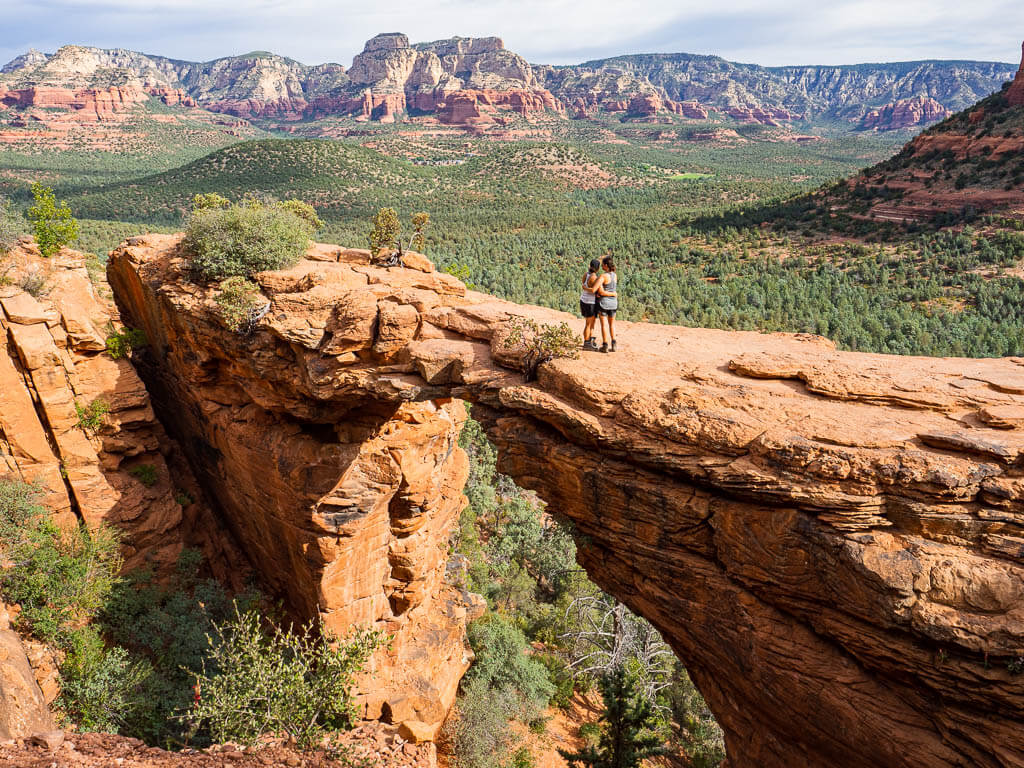
Devil’s Bridge is one of the most iconic natural sandstone arches in the area. To get to Devil’s Bridge, you can choose various hiking trails in Sedona ranging from easy to moderate.
There are two different parking lots for passenger cars and one parking lot for 4×4 vehicles. If you have a high clearance 4×4 vehicle, you will be able to drive right to the Devil’s Bridge trailhead along Dry Creek Road.
If you don’t, you can park your vehicle in the parking lot on Long Canyon Road for the Mescal trailhead. From here, you have to take the Mescal trail to Chuck Wagon trail to Devil’s Bridge trail. Or you can park at the Dry Creek Vista Trailhead and take the entire Chuck Wagon trail to the Devil’s Bridge trailhead.
No matter which Sedona trail you take, they are all well marked and easy to follow. The trail is relatively flat until you reach Devils Bridge Sedona. Here you will have a little bit of a climb. Before overlooking Devils Bridges there will be one last steep climb. But once you have made it, look to the left and there will be the gorgeous natural arch.
Don’t worry about missing it. There will be a bunch of fellow hikers, taking photos, or sitting near it.
If you are brave enough, you can take a walk across the bridge. It is actually wider than you think when you are up close, but please still proceed with caution because it is a significant drop.
Top Tip: Looking for more information on the Devils Bridge trail, then read our Devils Bridge Sedona: Detailed Hiking Guide.
DEVILS BRIDGE TRAIL FEATURES:
- Largest natural sandstone arch in Sedona area
- Stunning views of the Red Rock country
- Variety of desert plants along the trail
- The thrill of walking on or across the natural bridge
TIPS FOR DEVILS BRIDGE TRAIL:
1. Start early – Devils Bridge is a very popular hike in Sedona and becomes very crowded. If you are looking to avoid crowds and capture an epic photo on the bridge by yourself without waiting in a long line, start your hike early.
2. Parking Options – There is limited parking, so don’t miss out on getting a parking spot because you arrived too late. However, you do have 2 options to choose from, the parking lot on Dry Creek Road or the even smaller lot at the Mescal trailhead on Long Canyon Road.
3. Choose the most scenic Sedona trail – All roads lead to Devils Bridge but which one is the best? You definitely want to avoid hiking the shortest and very dusty Forest Road 152. It is the road for 4×4 vehicles to reach Devils Bridge trailhead. Find out more about the most scenic Sedona trail in our detailed post about Devils Bridge.
6. Soldier Pass Trail (No. 66)
SOLDIER PASS TRAIL STATISTICS:
Difficulty: Moderate
Length: 4.5 miles
Type of Hike: Out and Back
Time: 3 to 4 hours
Elevation: 620 ft (about 800 ft if you climb to Soldier Pass Cave)
Location: Forest Service 9904 Road
Trailhead: Soldier Pass Trail No. 66 / Soldier Pass Trailhead
When to Hike: The best time to hike Sedona’s Soldiers Pass trail is in spring and fall early in the morning.
Permit: Yes
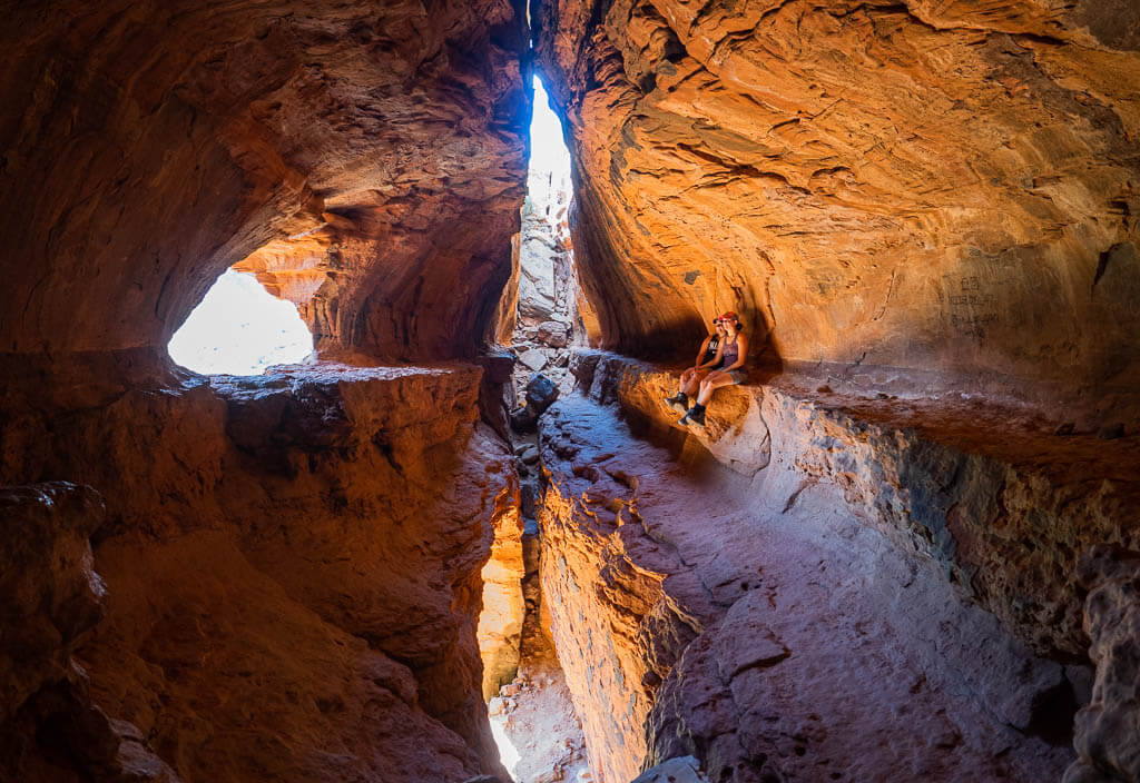
The Soldiers Pass Trail features one of the most remarkable shaped caves we have seen so far. But the beauty didn’t stop there. Along the trail, you will also find several other cool features, which will keep you fascinated during the entire hike.
Hiking Sedona, Soldiers Pass trail is fairly easy, but unfortunately finding the Soldiers Pass Cave will be a little more tricky.
From the Soldiers Pass trailhead, you will follow the trail to the Devil’s Sinkhole which is about 0.25 of a mile on the trail. The sinkhole sits at the base of Sphinx Rock. As you continue along the Soldier Pass trail, you will reach the Seven Sacred Pools which are a series of shallow pools that have been naturally carved out into the sandstone.
After, the Sedona hiking trail will run parallel to the 4WD dirt road for a little until the jeep trail ends. For a short period of time, the jeep trail and Soldier Pass trail will merge into one common Sedona trail.
Soon you will be entering the Red Rock Secret Mountain Wilderness area. At this point, you will be able to connect with different hiking Sedona trails to extend your hike on the Soldier Pass trail or check out the Soldiers Pass Cave.
Top Tip: Find out how to get to Soldiers Pass Cave, with our complete guide to finding the hidden cave.
SOLDIER PASS TRAIL FEATURES:
- Devils Sinkhole
- The Seven Sacred Pools
- Soldier Pass Cave
- Fantastic views of red rock formations and cliffs
TIPS FOR SOLDIER PASS TRAIL:
1. Limited parking – Parking is extremely limited with only about 14 parking spots. The parking lot is gated and no parking is allowed outside of the gates on the road. The lot is only open from 8:00 AM to 6:00 PM. So get there early, secure your spot and make sure you leave before the gate closes.
2. Beat the heat – Like some of the other trails in Sedona, shade is very limited. Try to avoid hiking Sedona during the middle of the day during the hotter months. If you can’t, don’t forget to pack plenty of water and snacks for the hike.
3. Do your research – The Soldier Pass trail is a fun and beautiful hike but the real gem you don’t want to miss is the Soldier Pass Cave. If you want to make sure to find it, you have to do some research before you go. Even though we planned ahead, we got lost and had a hard time finding the path leading up to the cave. To make it easier for you, we wrote a post with all the in-depth instructions you need to know to hike to the Soldier Pass Cave.
Difficult Hikes in Sedona Arizona
7. Boynton Canyon (No. 47) + Subway Cave
BOYNTON CANYON TRAIL STATISTICS:
Difficulty: Moderate
Length: 7.1 miles
Type of Hike: Out and Back
Time: 4 to 6 hours
Elevation: About 1,100 feet
Location: Boynton Canyon Road
Trailhead: Boynton Canyon Trailhead
When to Hike: The hiking trails Sedona are great all year round. Start your hike early.
Permit: Yes
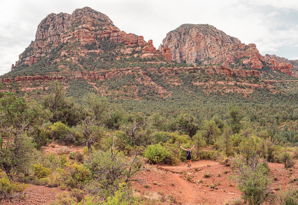
The Boynton Canyon trail is a top Sedona hiking trail with hikers eager to reach the Subway Cave. This Sedona hike also features the exquisite desert landscape like many of the other best Sedona hikes.
The trail begins off flat. After 0.3 miles you will get to the first trail junction where you can decide if you want to make an optional short detour on the Boynton Canyon Vista trail. It is a short steep ascend up red rocks with insane views of Boynton Canyon and the Sedona mountains. Along the way, you will be immersed with towering red rock cliffs, plants, and trees.
Back on the Boynton Canyon trail, you will have to look at the 2-mile mark (or the 2.4-mile mark if you did the detour) to find the turn to head to the Subway Cave. At the turn, you will have to take the trail to the right which leads you through the forest and red rock cliffs. It will be about 0.4 miles to the Subway Cave.
To get into the cave, you will have to walk up a slippery sandstone ascent. At the top of the incline, you will be at the back of the cave. Turn around and be in awe of this unique Sedona cave.
BOYNTON CANYON TRAIL FEATURES:
- Desert scenery with towering buttes and red rocks
- Subway Cave
- Incredible views of the Sedona mountains
TIPS FOR BOYNTON CANYON + SUBWAY CAVE
- Start your hike early – There are a few advantages to hitting the hiking trails in Sedona early. You are more likely to find a parking spot in the trailhead parking lot, beat most of the crowds, and hike in Sedona when the sun isn’t beating down on you. Try to be at the trailhead before 7:00 AM.
2. Plan extra time – Being a popular hike in Sedona you can plan to share it with many other hikers. You should plan about 1 hour or so inside the Subway Cave especially if you are looking for a great photo opportunity.
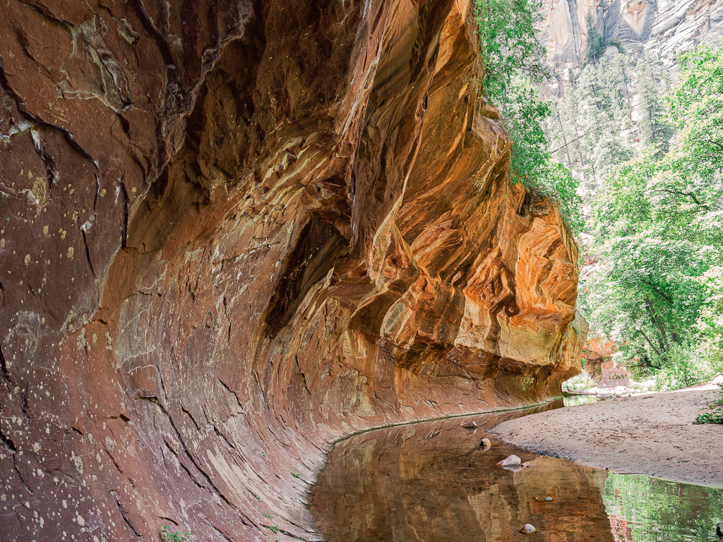
8. West Fork Trail (No. 108)
WEST FORK TRAIL STATISTICS:
Difficulty: Moderate to Difficult (due to the length)
Length: 7.2 miles
Type of Hike: Out and Back
Time: 3 to 4 hours
Elevation: Just over 800 ft
Location: Call of the Canyon Day Use Area
Trailhead: West Fork Trailhead
When to Hike: The Sedona trail is best to hike all year round. Best to go early to find a parking spot.
Permit: Entrance Fee – $11 per car or $2 per person walk-in
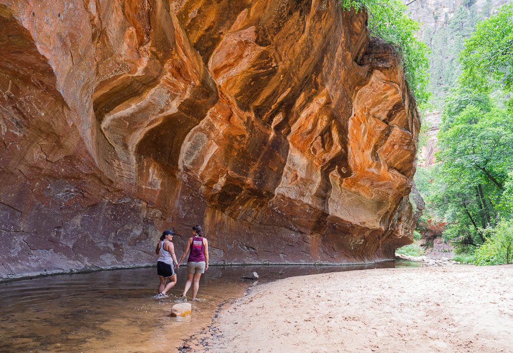
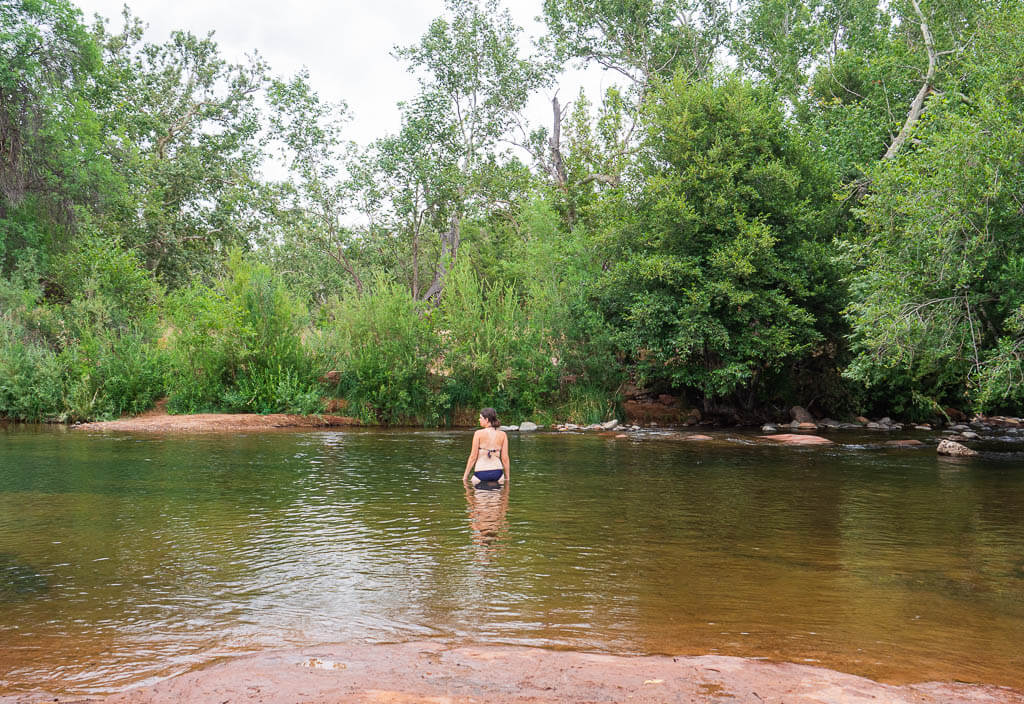
The West Fork trail is a perfect choice to hike year-round, especially in the summer, because you can find lots of shade along the trail. Plus, for an added bonus there are about 13 creek crossings and some waterholes to swim in.
The trail starts out in one of Oak Creek Canyon’s grassy flats. Then you will take a right into West Fork.
Soon you will be up close to the magnificent canyon walls. From this point on you will find yourself having to cross over the creek various times. We highly recommend a good pair of water-resistant shoes or hiking sandals.
If you are not really into getting your feet wet, you can try to avoid the water by crossing the river on bigger rocks laying in the water.
Top Tip: The West Fork trail slightly reminded us of our hiking experience in Zion National Park when we hiked the Narrows.
WEST FORK TRAIL FEATURES:
- River-crossings
- Waterholes to swim in
- High canyon walls
- Shaded hike in Sedona
TIPS FOR WEST FORK TRAIL:
1. Parking – Since this is a very popular hike in Sedona, the parking lot fills up quickly. When this happens you can find parking along Arizona State Route 89A. Unfortunately, this road is very busy and there is not a lot of extra pavement which makes the walk to the parking lot a little dangerous. Try to arrive early in the day, especially during busier months of the year, to avoid this situation.
2. Have appropriate footwear – The trail requires you to cross the stream multiple times. Make sure to wear some type of waterproof footwear to fully enjoy this experience. We love our Chacos or Bedrock hiking sandals and our Tropicfeel shoes which are super comfortable and dry quickly after being used in the water.
3. Entrance Fee – There is a required entrance fee to get to the hike Sedona. If you are lucky enough to get a spot in the parking lot, it will cost you $11 for up to 5 people. If you find yourself parking along the road and walk in, you have to pay $2 a person.
Sedona Arizona Hiking Trail Map
Looking for More Incredible Hikes in Sedona?
Unfortunately, our 5 days stay was not long enough to explore all the stunning hikes Sedona has to offer. Since we can’t wait to come back, we already made a list of hiking trails in Sedona we want to check out for our next stay.
More Easy Hikes in Sedona, Arizona
Fay Canyon Trail – Many people come to hike this 1.2 mile out and back trail to see the natural arch. Fay Canyon is also home to a wide variety of desert plants and provides incredible views of the surrounding cliffs.
Deadmans Pass Trail – If you are looking to extend your Birthing Cave hike (Long Canyon Trail), then this 2.8 miles out and back trail will be perfect for you.
Wilson Canyon Trail – Especially during the hotter months, the 3 miles out and back Sedona trail, is very convincing since it provides some shade. Take a small detour to view Steamboat Rock and end with 360-degree views of the surrounding canyon walls.
Coffee Pot Rock Trail – Want to admire more of the breathtaking rock formations in Sedona up close? Then take this easy 2.4 mile out and back trail to the base of the well-known Sedona landmark, Coffee Pot Rock.
More Moderate Hikes in Sedona, Arizona
Doe Mountain Trail – Ascending about 400 ft, the 1.5-mile loop provides you with a dramatic view overlooking some of the most popular Sedona landmarks, like Chimney Rock.
Courthouse Butte Loop – This enjoyable 3.9-mile loop along the red rock formations Bell Rock and Courthouse Butte is gorgeous. You can expect rocky terrains, dry washes, some woodlands, and grasslands.
Airport Mesa – Drive the Airport Mesa Scenic Drive to hike the 3.5-mile trail along Tabletop Mountain. This loop will reward you with a great view of Sedona and its fabulous red rock formations. Don’t miss the short side trail that leads to a popular vortex spot in Sedona. For a unique dining experience, visit Mesa Grill, next to the airport.
Brins Mesa Trail – This 6.0 mile out and back Sedona trail will take you through Mormon Canyon to the top of Brins Mesa. When you’re lucky, you will be able to spot some wildlife and wildflowers on your hike.
More Difficult Hikes in Sedona, Arizona
Bear Mountain Trail – An unshaded, steep 4.9 mile out and back hike in Sedona will lead you to the summit of Bear Mountain, one of the most popular mountains in Sedona. Take on the challenge and you will be rewarded with spectacular panoramic views.
Wilson Mountain Trail – Looking to hike the highest red and white sandstone peak near Sedona? Give this spectacular 11 mile out and back trail a try.
Do you Need a Permit to Hike in Sedona?
You will need a Red Rock Pass or an equivalent pass for most of the hikes in Sedona. A Red Rock Pass is a permit that is required when utilizing hiking trails in Sedona that are on National Forest Land. When a pass is required, it needs to be visibly placed on your vehicle’s windshield.
The Red Rock Pass can be purchased at a self serve machine that is located at many of the trailheads, Ranger Stations, the Sedona Chamber of Commerce Visitor Center, and at local businesses in Sedona. It costs $5 for single-day use, $15 for 7 consecutive days, and $20 for 12 consecutive months.
Other passes that are accepted are the America the Beautiful Interagency Pass, Golden Access Pass, and Golden Age Pass.
Things to Consider When Hiking in Sedona AZ
1. PACK LOTS OF WATER!
Sedona is located in the desert, so you can imagine the temperature can get extremely hot during the summer. Many of the hikes Sedona has to offer have little to no shade.
It’s important to pack enough water for your hike to stay hydrated. Be smart. Keep your water cool and refreshing with a Hydro Flask insulated bottle.
Learn more about Hydration Basics to make sure you are packing enough liquids for your hike.
2. STAY PROTECTED FROM THE SUN
Make sure you are protecting yourself from the hot sun rays with sunscreen and sun protection clothing.
Remember Sedona is in the desert and there is little shade to be found on the trails in Sedona, so the chance of getting a sunburn is pretty high. Don’t let sunburn ruin your Sedona hiking trails experience.
3. BE AN EARLY RISER
We visited Sedona in July, one of the hottest months of the year. Due to the breakdown of our car, we arrived late and made the mistake of starting one of our hikes in Sedona around noon. It was so hot, that not just the landscape was breathtaking.
Start your hikes in Sedona early in the morning or later in the afternoon, especially during the summer months. The Sedona hiking trails tend to be a little less crowded and the weather is more pleasant.
Don’t forget to bring a good headlamp when you go on a hike to enjoy a sunrise or sunset. All of the hiking trails Sedona are doable when it’s dark as long as you have a proper light source.
4. BE AWARE OF WILDLIFE
When you go hiking in an area you are not familiar with, it is good practice to familiarize yourself with the wildlife.
Most of the time, you will only come in contact with the non-dangerous wildlife on the best Sedona hikes. But on occasion you could come across a rattlesnake, which is on the trail or curled up under a rock, so make sure you educate yourself before you hike in Sedona.
5. LEAVE NO TRACE
Anytime you enjoy the outdoors, it is imperative to follow Leave No Trace principles. The general idea is to leave nature the way it is so that the next generations can enjoy it too. Doesn’t that sound pretty awesome?
Learn more about Leave No Trace.
6. FINDING PARKING
During Sedona’s high season from March to May and September through mid-December parking can be very nerve-racking. Most of the hiking trails in Sedona parking lots are small and fill up quickly.
If you want to hike specific trails in Sedona, know all your parking options ahead of time and prepare a plan B if you are not lucky enough to get your desired parking spot. There are so many awesome hikes in Sedona to choose from. You can always come back and try again. Don’t take the risk of getting a ticket because you parked illegally.
Have you completed one or more of these hikes in Sedona?
Share with us your favorite Sedona hiking trail and your experience in the comments below!
You May Also Like:
- Hiking: What You Should be Packing for a Hike: The Essentials + Extras
- Hiking: 100+ Best Gifts for Hikers to Buy
- Apps: 15 Most Helpful Hiking Apps to Download
- Quotes: 100+ Best Hiking Quotes to Inspire Your Future Adventures
- National Park Pass: How to Save Money with the America the Beautiful Pass
- National Parks: First Hand Ranking of National Parks in the US from Best to Worst
- Arizona: How to Secure a Permit to Havasu Falls
- Utah: Kanarra Falls Trail Guide: The Slot Canyon You Don’ Want to Miss
Save this Post for later on Pinterest!

Did you like this post? Subscribe to our newsletter and we’ll send you more unique travel tips, updates, and even FREE content!

Appreciating the time and effort you put into your website and in depth information you offer. Awesome places to explore. I would like to suggest it to my friends so that we can plan a trip and take a time for ourselves in this busy schedule. Worth sharing! Keep posting such wonderful places. Thanks a lot!
Thank you we appreciate the support. Sedona is one of our favorite places. Enjoy your visit when you go!
Do you recommend hiking boots or trail shoes? I was thinking boots because of snakes and because the red dirt will do a number on my trail shoes… What do you think?
For most of the hikes, we wore hiking boots. We just prefer wearing them. However, it depends on the trail. For the West Fork Trail we wore our hiking sandals since you go through water. You could probably get away with trail shoes on certain hikes. But for cathedral rock, we would definitely recommend boots. Overall, our recommendation is hiking boots.
This Sedona hike guide is incredibly helpful. You’ve really thought through everything you need to know before planning a trip. Thank you for this helpful resource. Saving this guide for later!
Thank You. We are very happy that our post was useful to you!